
Edmonton’s best views are not gathered around one observation tower where you buy a ticket, ride an elevator and emerge above the city. You have to move around a little.
Downtown sits high above the North Saskatchewan River, so the scene changes depending on which bank you are standing on. From the downtown side, the river valley spreads out below you. Cross to the south bank and the skyline becomes the subject. Walk closer to Walterdale Bridge and the bridge takes over the frame. Ride the High Level Bridge Streetcar and the whole view starts moving beneath you.
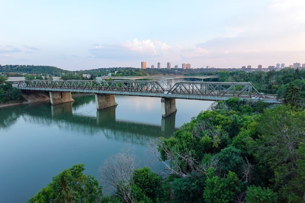
I spent a lot of time in the river valley when I lived in Edmonton. I jogged there, walked there and even went inline skating on the trails. It was my tranquil escape during my university years, so coming back with Audrey after more than a decade felt familiar and surprisingly different at the same time.
Some trails seemed more developed. The central riverfront was easier to reach. The 100 Street Funicular, which did not exist when I lived in the city, removed one of the more annoying parts of exploring Edmonton on foot: descending a very large hill knowing you eventually have to climb it again.
The result is that Edmonton now has several excellent places to see the river, bridges and skyline without needing to commit to a major hike. The trick is choosing the stop that shows what you actually came to see.
The Quick Decision: Which Edmonton View Is Best for You?
| Viewpoint or experience | Choose it for | What to know |
|---|---|---|
| 100 Street Funicular and Frederick G. Todd Lookout | The easiest downtown introduction to the river valley | Free and central, but the mechanical funicular has limited operating hours and weather-related closures |
| Laurence Decore Lookout | The classic downtown skyline with Walterdale Bridge | Strongest postcard-style composition; some approaches are steeper than others |
| Walterdale Bridge and the Kinsmen riverfront | A longer scenic walk with the bridge as part of the experience | Better when you have time to move between river level and the south-bank viewpoints |
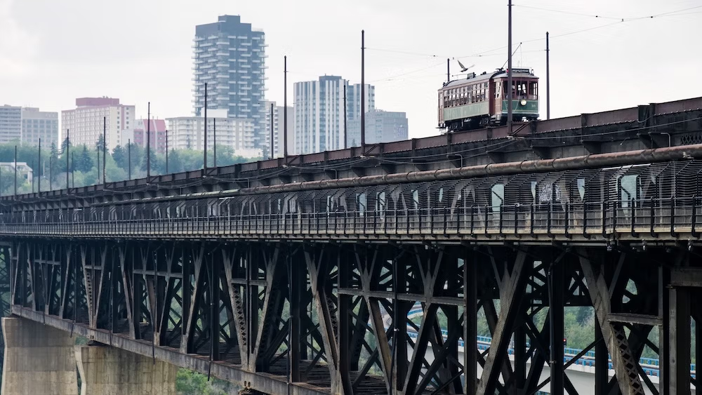
| High Level Bridge Streetcar | The most memorable moving view | Seasonal, paid and not reliably accessible for every wheelchair or stroller |
| Gallagher Park | A broader skyline view near the Muttart Conservatory | Easy to combine with Cloverdale and the Muttart, but it is a park rather than one marked lookout |
| Keillor Point | A natural river-valley panorama away from downtown | Best when the river and wooded valley matter more than the skyline |
For most first-time visitors staying downtown, I would begin with the 100 Street Funicular and Frederick G. Todd Lookout. It is the simplest place to understand why Edmonton looks the way it does.
For the strongest downtown skyline photograph, go to the south bank and prioritize Laurence Decore Lookout.
For the most enjoyable experience rather than the most convenient one, ride the High Level Bridge Streetcar while it is in season.
Where to Stay for Edmonton’s Best View Routes
Downtown is the easiest base if the funicular, Frederick G. Todd Lookout, Louise McKinney Riverfront Park and the northern streetcar stops are your priorities. You can begin several of the routes in this guide on foot instead of driving to each individual viewpoint. Travellers comparing locations and budgets can compare hotels in Downtown Edmonton on Booking.com.
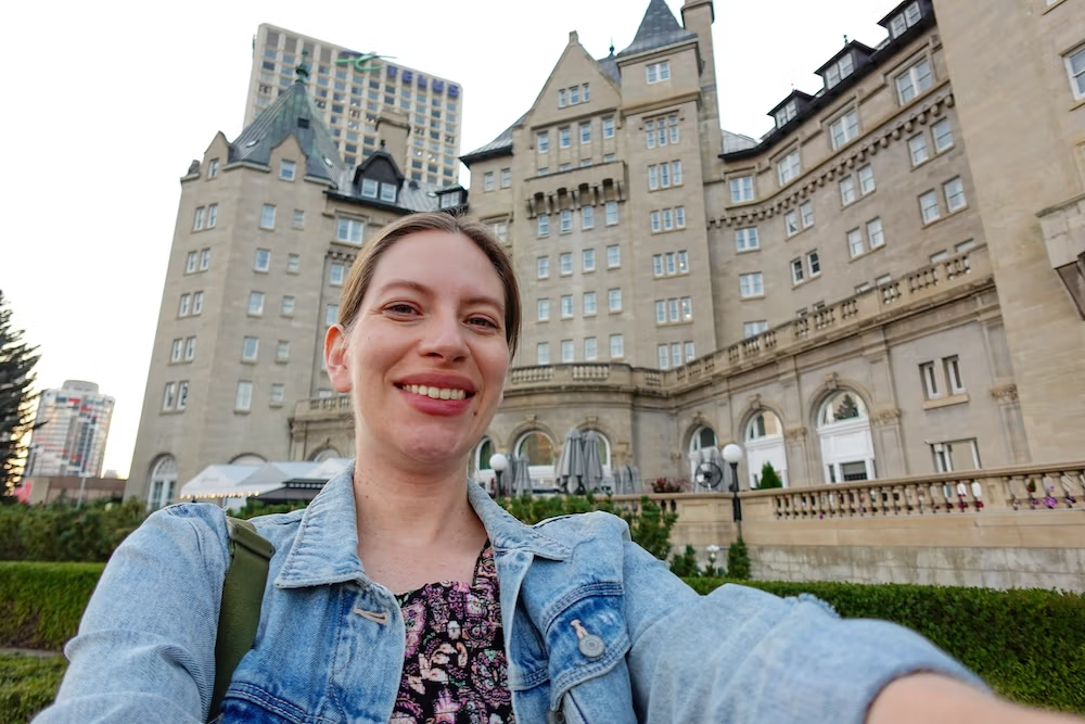
The Fairmont Hotel Macdonald is the most relevant specific option for this article because Audrey and I stayed there and used the surrounding downtown and funicular area as the starting point for our river-valley exploring. The hotel overlooks the valley, although individual room views vary considerably. You can check current availability at Fairmont Hotel Macdonald.
Old Strathcona is a better fit when your plans revolve around Whyte Avenue, the High Level Bridge Streetcar, Kinsmen Park and the south-bank viewpoints. It is less convenient for starting at the downtown funicular but more natural for combining the skyline stops with Edmonton’s livelier south-side neighbourhood. You can compare places to stay near Old Strathcona.
Why the Same River Valley Produces Completely Different Views
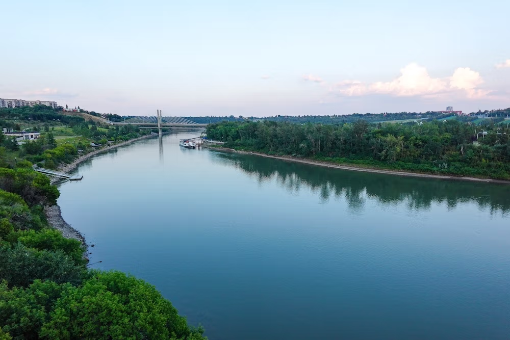
Edmonton’s downtown edge sits above the north bank of the North Saskatchewan River. That elevation creates lovely views into the valley, but it does not always give you the complete skyline because you are already standing beside or among the downtown buildings.
The south bank solves that problem. From Queen Elizabeth Park, Kinsmen Park and the hills above Walterdale Bridge, you can look back across the river and see downtown rise as one scene.
This distinction sounds obvious once you are standing there, but it matters when planning. A place can be elevated, scenic and close to downtown without providing the skyline photograph you imagined.
The bridges complicate things in a good way.
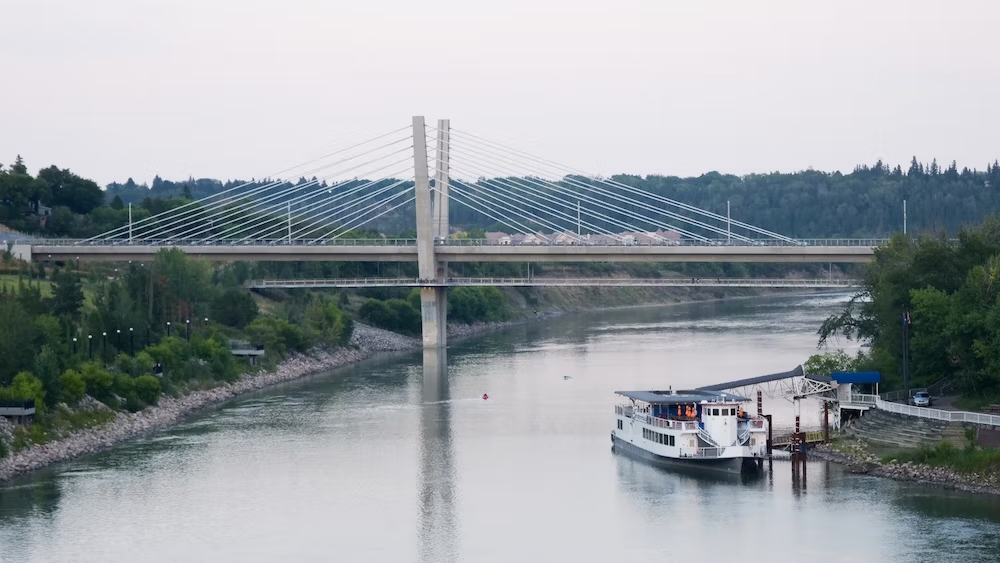
Walterdale Bridge is one of the most photogenic objects in the central valley, but the strongest view of it is often from somewhere beside or above the bridge rather than from the bridge deck. The High Level Bridge works differently. Its historic streetcar turns the crossing itself into the viewpoint.
I would divide Edmonton’s views into four simple types:
- Looking down into the river valley.
- Looking back toward downtown.
- Using a bridge as the main visual subject.
- Experiencing the valley while crossing above it.
Once you decide which of those you want, the best stop becomes much easier to choose.
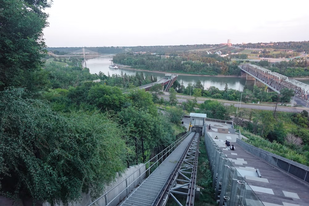
100 Street Funicular and Frederick G. Todd Lookout
The 100 Street Funicular is the viewpoint I would recommend first because it connects directly to downtown and asks very little of you physically.
Audrey and I approached it from the Fairmont Hotel Macdonald area after spending the evening around the hotel grounds. When I lived in Edmonton, getting down to the river usually meant committing to the hill. Now you can step inside a glass car and let the city do some of the work.
I appreciated that immediately.
We had already been sightseeing around Alberta, Audrey was well into her pregnancy, and neither of us needed to prove anything by marching down a steep riverbank unnecessarily. The funicular saved our legs for the part we actually wanted to enjoy: walking beside the river.
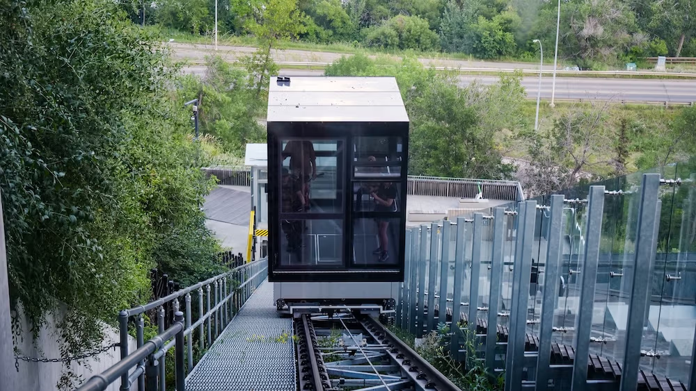
The ride is only the first part of the system. The glass-enclosed car descends from downtown to a promenade. From there, a pedestrian bridge crosses above Grierson Hill Road and leads toward Frederick G. Todd Lookout. A second elevator or a set of stairs continues down to the river-valley trails.
In total, the upper-to-lower connection extends for roughly 260 metres. It is not one uninterrupted elevator ride from downtown to the river.
Frederick G. Todd Lookout has built-in seating and a glass railing. Face south and you are looking into the river valley. Turn around and downtown rises behind you. That makes it more useful as an introduction to Edmonton’s geography than as a single dramatic skyline platform.
The funicular is free. The mechanical funicular and lower trail elevator are currently listed as operating from 7:00 am to 9:00 pm. The surrounding promontory, stairs, promenade, pedestrian bridge and lookout remain open from 5:00 am to 11:00 pm.
There are a few catches.
The funicular shuts down for the remainder of the day when the outdoor temperature reaches 30°C or drops to −30°C. Planned maintenance normally takes place on the second Wednesday of each month. Mechanical problems and temporary closures can also affect the step-free route between levels.
The car was designed to accommodate wheelchairs, walkers, bicycles and strollers, but visitors who depend on both elevators should check the current funicular status before setting out.
Once you reach the lower trail network, Louise McKinney Riverfront Park gives you room to extend the outing. The park has a promenade, benches and approximately 500 metres of unobstructed river frontage. Parking near river level is limited, so starting downtown and using the funicular makes more sense for many visitors.
Is the Fairmont Hotel Macdonald a Viewpoint?
The Fairmont Hotel Macdonald has one of Edmonton’s finest river-valley settings.
We went outside around sunset during our stay and found summer flowers, outdoor dining and the château-style hotel rising behind us. It felt wonderfully removed from the city even though we were still downtown.
However, I would not send someone there expecting a free municipal observation deck. The terraces and patios are connected to hotel and restaurant operations, and access can change with renovations, events and seasonal service.
The hotel’s Harvest Room and Terrace are temporarily closed for renovations, with a reopening planned for fall 2026. The public funicular promenade and Frederick G. Todd Lookout are the more reliable recommendations for visitors who simply want the view.
Our room also taught us something about Edmonton view terminology. Audrey had booked a city-view room, but it had one narrow window and felt much darker than expected. She said she would choose a river-valley-facing room next time.
We did not stay in both categories, so I cannot declare the river-facing rooms universally better. I can say that the words “city view” on a booking page do not guarantee the broad skyline panorama you may be picturing.
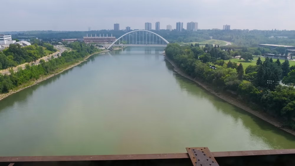
High Level Bridge Streetcar
The High Level Bridge Streetcar is not Edmonton’s easiest viewpoint, and it is certainly not the most flexible. It is seasonal, it costs money and it operates on a timetable.
It was also the most fun view experience we had.
I had watched the streetcar cross the bridge when I lived in Edmonton but had never ridden it. Returning with Audrey finally gave me the excuse to play tourist in my old city.
The historic car travels between Old Strathcona and central Edmonton, crossing the river valley high above the water. Instead of standing still and composing one photograph, you watch the river, trails, bridges and skyline shift around you.
It feels wonderfully quirky, and it performs a practical job too. Stops connect the Whyte Avenue and Old Strathcona area with Garneau, Government Centre and Jasper Plaza. A return ticket permits stopovers, so you can ride across, explore and catch a later streetcar back.
For the 2026 season, regular service runs Thursday through Monday from May 15 to September 7. It then continues Friday through Sunday until October 12.
The current fare is $10 return or $5 one way for passengers aged six and older. Children five and younger ride free under normal conditions, and a family return ticket is available for qualifying groups.
Tickets are sold by the conductor. Cash, debit, credit cards and mobile payments are accepted. Reservations are not available, and boarding is first-come, first-served.
There is no dedicated parking, which is another reason to treat the streetcar as part of an Old Strathcona or downtown outing rather than an isolated attraction.
Check the current High Level Bridge Streetcar schedule before planning around a specific departure. Service can vary by date and event.
The largest practical limitation is accessibility. Most of the historic cars have limited or no wheelchair and stroller access. The operator tries to run an accessible Melbourne streetcar on weekends when possible, but that vehicle cannot be guaranteed and its ramp is only available at Strathcona. Operations also change during the Edmonton Fringe Festival.
Large strollers may need to be left at one of the operator’s facilities. Smaller strollers are accepted only when space permits and the conductor approves them.
For a visitor who needs predictable step-free access, the funicular is the stronger choice.
For everyone else, the streetcar offers something no fixed lookout can: the feeling of travelling through the view instead of merely arriving at it.
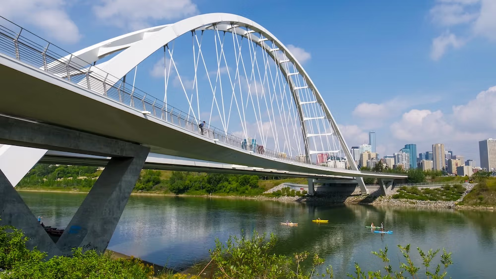
Laurence Decore Lookout and Queen Elizabeth Park
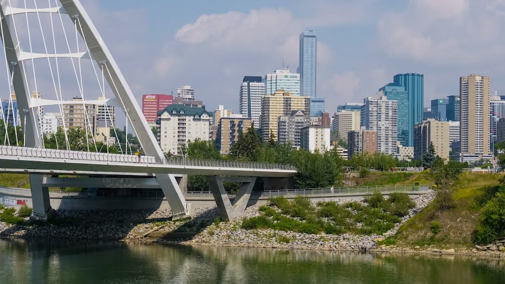
If your main goal is the classic photograph of downtown Edmonton with Walterdale Bridge and the river valley below, Laurence Decore Lookout is the strongest choice in this guide.
The lookout sits near Saskatchewan Drive and 106 Street in Queen Elizabeth Park. Its position on the south bank lets you face downtown from a distance, which is exactly what the north-bank viewpoints cannot do as well.
From here, Walterdale Bridge can sit in the foreground while the downtown buildings rise beyond it. The river and wooded valley keep the composition from becoming a simple cluster of office towers.
Queen Elizabeth Park is open from 5:00 am to 11:00 pm. Washrooms are currently listed from 9:00 am to 9:00 pm. The west parking lot has designated accessible spaces and curb cuts.
The difficulty depends on how you arrive.
The primary multi-use path connecting Queen Elizabeth Park with the Kinsmen area is paved and relatively flat, with gentle inclines. Approaching from Saskatchewan Drive can involve steeper grades or stairs.
Construction is another temporary complication. Road and trail renewal is taking place on the east side of Queen Elizabeth Park Road until fall 2026, while the west parking lot remains available. Anyone visiting during this period should check the current Queen Elizabeth Park access information.
Audrey and I explored the central riverfront during our return to Edmonton, but I cannot honestly present Laurence Decore Lookout as one of our tested stops based on that alone. I include it because its position solves a very specific reader problem: where to stand when you want Edmonton’s skyline and Walterdale Bridge in the same scene.
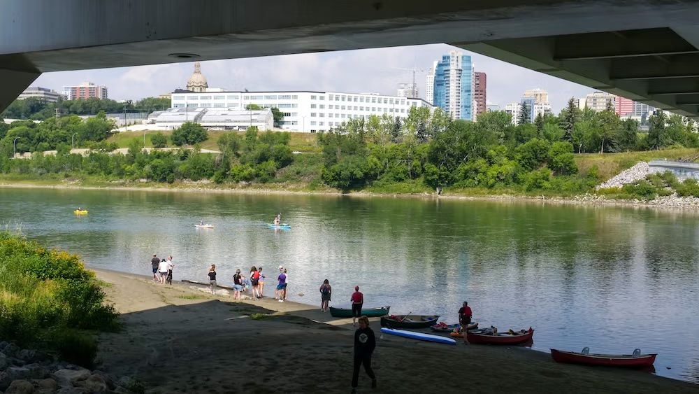
Walterdale Bridge and the Kinsmen Riverfront
Walterdale Bridge deserves to be experienced from more than one position.
From the bridge deck, you are inside the crossing. The river opens below, the banks pull apart and the valley becomes the main subject.
From Kinsmen Park or the hillside above it, the bridge becomes part of the picture.
That difference is why I would not treat “Walterdale Bridge viewpoint” as one exact pin. The wider area works better as a short scenic route.
Kinsmen Park sits on the south bank between the High Level Bridge and Walterdale Road. It has parking, paved walking and cycling paths, designated accessible spaces and curb cuts. The park is open from 5:00 am to 11:00 pm.
The washrooms are seasonal. They operate during summer but are closed from October through May, which is worth remembering before committing to a winter walk.
Walterdale Bridge itself includes pedestrian and cycling connections, so crossing on foot is a legitimate part of the outing. However, the most satisfying bridge photograph may come from a nearby south-bank trail or elevated lookout rather than from the bridge.
The lower paths, bridge deck and upper Queen Elizabeth viewpoints are connected, but they are not one effortless stop. Moving between river level and the hillside can involve a longer route, a noticeable incline or stairs.
Walking From the Funicular to Walterdale Bridge
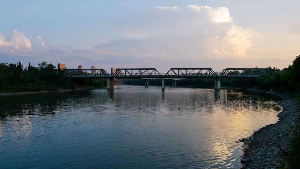
One of the best ways to understand Edmonton’s central views is to start downtown, descend through the funicular system and follow the riverfront toward Walterdale Bridge.
The commonly published route from Frederick G. Todd Lookout to the bridge is approximately 1.5 kilometres each way, or three kilometres return. A straightforward walk can take around an hour, although photography stops, construction and detours can easily stretch that.
The main route is wide, paved and mostly flat. It passes through Louise McKinney Riverfront Park, Irene Parlby Park and the Rossdale area before approaching Walterdale Bridge.
What I like about this sequence is how gradually the city changes.
You begin above the valley. Then you descend to river level. Other bridges pass overhead. Downtown partially disappears behind the slope and trees. Finally, Walterdale Bridge becomes much larger and more dominant than it appeared from above.
Audrey and I walked along the central riverfront during our trip, but I would not pretend that we followed every metre of this precise route or crossed Walterdale Bridge during that walk. I recommend it because the locations connect naturally and the progression makes sense.
Check the City’s current trail cautions and closures before setting out. Construction, erosion and temporary closures can alter river-valley paths.
A return walk is the simplest option. Continuing across the river toward Kinsmen Park and Queen Elizabeth Park creates a stronger finish, but it also leaves you on the opposite bank and may involve an uphill return.
A Guided Option for Covering More Ground
Travellers who would rather have someone else connect the city highlights and river-valley paths can consider a currently listed three-hour guided bike tour. I did not take this tour, but the format suits visitors who want to cover more distance than a walking route without planning every turn themselves. You can see the current Edmonton city and river-valley bike tour on GetYourGuide.
Gallagher Park
Gallagher Park provides a different skyline setting from Laurence Decore Lookout.
It sits in Cloverdale near the Muttart Conservatory and the Edmonton Ski Hill. Downtown appears across the valley, but the scene feels broader and more open than the tighter Walterdale composition.
There is no single formal lookout platform where everyone stands in exactly the same place. You find the view by moving through the park and using the open slopes and paths.
The park is open from 5:00 am to 11:00 pm. It has parking, walking and cycling trails, lower curb heights and a designated drop-off point. The current park information does not list a public washroom, so I would not arrive expecting one.
Audrey and I visited the Muttart Conservatory, but being nearby does not mean I can claim Gallagher Park as a firsthand viewpoint stop. I include it because it performs a different job from the south-bank lookouts.
If you are already visiting the Muttart and want to add a skyline view without crossing to Queen Elizabeth Park, Gallagher is the logical choice.
Keillor Point
Keillor Point belongs on this list because it reminds us that Edmonton’s best view does not always need downtown in it.
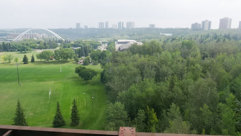
The official viewing area sits at the top of the riverbank along Saskatchewan Drive in Belgravia. From there, the river bend, wooded slopes and scale of the valley take priority over office towers.
That is the attraction.
Laurence Decore is where I would go for a recognizable Edmonton skyline. Keillor Point is where I would go when I wanted the city to recede and the river valley to dominate.
The viewing area is open from 5:00 am to 11:00 pm. It has been formalized as an accessible public viewpoint, although the available information does not provide the same level of detail found for the funicular or Queen Elizabeth Park.
There is no equally clear breakdown of washrooms, gradients, designated parking or the precise step-free route. Visitors with specific mobility requirements should confirm the approach before depending on it.
I did not visit Keillor Point with Audrey during this trip, so it is a researched recommendation rather than one of our personal stops.
When to See Edmonton’s Best Views
“Go at sunset” is lazy advice when every viewpoint faces a different direction.
For the Classic Evening Skyline
Laurence Decore Lookout makes the most sense for evening light and blue hour because it faces downtown. Walterdale Bridge, the river and the illuminated buildings can all share the same composition.
The park remains open until 11:00 pm, although operating hours do not guarantee clear paths, comfortable weather or a completely empty viewpoint.
For a Flexible Downtown Stop
The funicular area works well during the day and early evening. The public promenade, pedestrian bridge and lookout stay open later than the mechanical car.
A later visit may still be possible, but the easiest step-free connection between levels could be unavailable once the funicular and lower elevator stop operating.
For the Streetcar
Choose the High Level Bridge Streetcar for the ride rather than for perfect light.
Its timetable does not necessarily align with sunset, and you cannot stop the car halfway across because the sky suddenly looks magnificent. That lack of control is part of the experience.
For Autumn Colour and Natural Valley Views
Keillor Point should be especially appealing when the wooded valley becomes the subject. Gallagher Park also gives the skyline more breathing room and allows the surrounding landscape to carry more of the scene.
During Smoke or Winter Weather
Wildfire smoke can erase the skyline even while every park remains open. It can also affect health, not merely photography. Check Alberta’s live Air Quality Health Index before planning a long outdoor route during smoke season.
In winter, snow-clearing priorities do not guarantee bare pavement. Ramps, bridge approaches and trail junctions can remain slippery.
The temperature thresholds at the funicular matter too. Edmonton can occasionally reach both closure extremes, which is a very Edmonton problem to have.
Two View Routes That Make Sense
The Short Downtown Route
Begin near the Fairmont Hotel Macdonald and the upper funicular platform.
Ride down, cross the pedestrian bridge and stop at Frederick G. Todd Lookout. Return from there for a compact outing, or continue to river level through the lower elevator or stairs.
This is the best route for someone with limited time, especially if they are staying downtown and do not have a car.
The Longer Riverfront Route
Use the same funicular descent, then follow the riverfront west toward Walterdale Bridge.
Allow at least an hour for the basic return walk and more if you plan to take photographs, cross the bridge or continue into Kinsmen and Queen Elizabeth parks.
The fullest version creates a satisfying progression:
- Downtown elevation.
- Frederick G. Todd Lookout.
- River-level trails.
- Walterdale Bridge.
- A skyline view from the south bank.
It requires more planning than driving between lookouts, but the changing perspective is the entire point.
The Seasonal Streetcar Route
Ride the High Level Bridge Streetcar between central Edmonton and Old Strathcona, use the return ticket for a stopover and explore Whyte Avenue before crossing back.
It is less predictable than the self-guided routes. Boarding is first-come, schedules vary and the streetcar only operates during its season.
It is also far more interesting than simply driving over the bridge.
My Verdict on Edmonton’s Best Views
For a first-time visitor, I would choose the 100 Street Funicular and Frederick G. Todd Lookout. It is central, free and easy to combine with a riverfront walk. More importantly, it explains Edmonton’s geography almost immediately.
For the best downtown skyline with Walterdale Bridge, go to Laurence Decore Lookout.
For a longer outing, walk the riverfront between the funicular area and Walterdale Bridge, then continue toward the south bank if you have the energy.
For the most distinctive experience, ride the High Level Bridge Streetcar. It comes with more logistical nonsense than a public lookout, but it was the view experience that made me feel as though I was rediscovering Edmonton instead of merely revisiting it.
Gallagher Park works best as an addition to a Muttart Conservatory day. Keillor Point is the better choice when you want the river valley to overpower the city.
Before choosing a viewpoint, decide what you actually want in front of you.
Edmonton can give you the river, the bridge or the skyline. The best days are when you move around enough to see all three.
Frequently Asked Questions
What is the best Edmonton viewpoint for a first-time visitor?
I would begin with the 100 Street Funicular and Frederick G. Todd Lookout. It is central, free and easy to combine with a riverfront walk, while also showing how downtown connects with the North Saskatchewan River valley.
Where is the best view of Edmonton’s skyline and Walterdale Bridge?
Laurence Decore Lookout in Queen Elizabeth Park offers the strongest classic composition of downtown Edmonton, Walterdale Bridge and the river valley. Access difficulty varies because some approaches involve steeper grades or stairs.
Is the 100 Street Funicular free?
Yes. The funicular is free, but its mechanical components have narrower operating hours than the surrounding promenade and lookout. Extreme temperatures, planned maintenance or temporary mechanical issues can also interrupt service.
Is the High Level Bridge Streetcar worth riding for the view?
It was the most memorable view experience Audrey and I had in Edmonton. The historic streetcar provides a moving perspective over the river valley, although it is seasonal, paid, first-come and less predictably accessible than the funicular.
How long is the walk from the funicular to Walterdale Bridge?
The commonly published route is approximately 1.5 kilometres each way, or three kilometres return. A straightforward walk can take around an hour, but photography, construction and trail detours may add time.
Which Edmonton viewpoint is best for natural river-valley scenery?
Keillor Point is the strongest choice when the river bend, wooded slopes and scale of the valley matter more than downtown buildings. It is an official viewing area, but its detailed facilities and step-free approach are less clearly documented.
Are Edmonton’s river-valley viewpoints accessible in winter or during wildfire smoke?
Conditions can change considerably. Snow clearing does not guarantee bare pavement, the funicular has temperature-related closures and wildfire smoke can reduce visibility while also affecting health. Check live operating and air-quality information before setting out.
This guide is also available in Spanish. [Leé la versión en castellano: Mejores vistas de Edmonton: miradores del valle, puentes y skyline]
This article contains affiliate links. If you book through one of these links, I may earn a commission at no extra cost to you.