
Hakodate is one of the most pedestrian-friendly cities Audrey and I have visited in Japan, and it’s also very spread out. Both statements turned out to be true, which is the whole difficulty in answering whether it’s walkable. The sights gather into pockets that are easy on foot, the pockets sit a tram ride apart, and a lot of the effort in between comes from hills you can’t see on a map. We rode the tram into town from our hotel outside the centre and walked most of what came after. It was plenty of exercise and, on a hot day, a little grueling, but I’d do it the same way again. This is how that worked, how long the walks actually are, and which legs I’d hand to the tram.
The Short Answer: Walk the Districts, Ride Between Them
Hakodate breaks into pockets: the station and its market, the waterfront and Bay Area, Motomachi’s slopes climbing toward the ropeway, Goryokaku inland, and the hot-spring district of Yunokawa farther east. Inside the first three, walking is the obvious way to move. Between pockets, and out to Goryokaku and Yunokawa, you ride, since each hop costs roughly half an hour door to door.
We saw the same thing while we were there: pedestrian friendly, very spread out. What made it click was the view from the top of the ropeway, and again from Goryokaku Tower, where the city kept going well past the harbour side we’d been wandering. The tram is what lets you cover that ground without spending your legs on it. We loved saving our legs on the tram so that we could leg it around the districts, and I’d sum up the result as lots of exercise, a bit grueling in the heat, and worth every step. The walking and the trams both felt like part of the city’s character, and I’d have missed something if I’d skipped either.
How We Actually Got Around
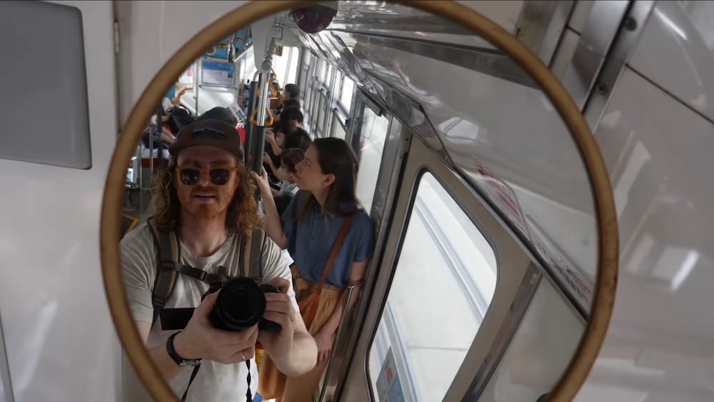
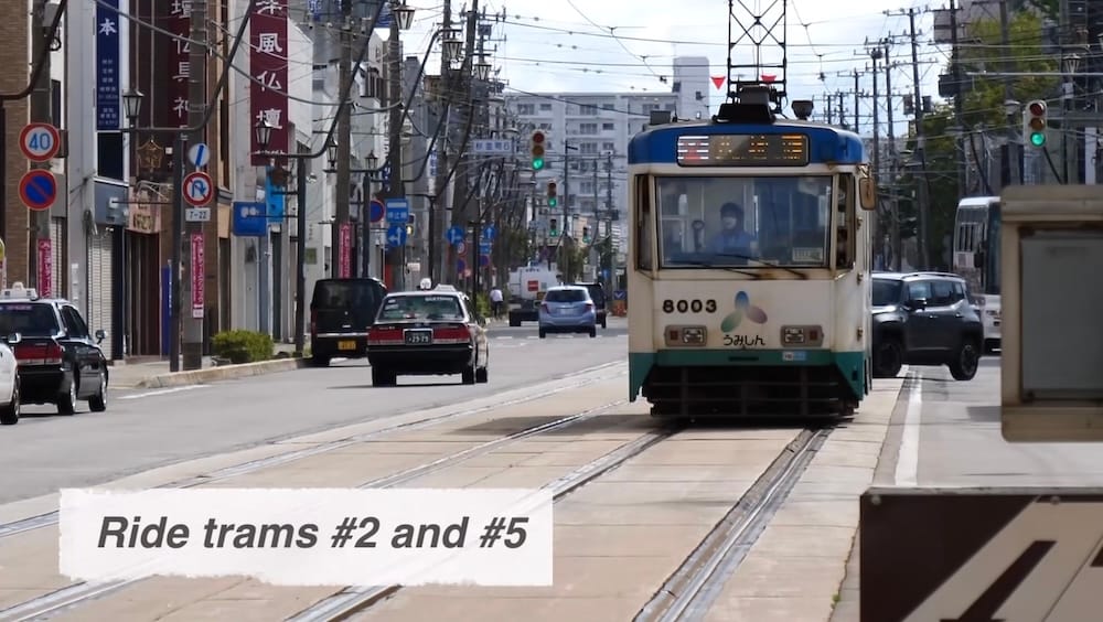
Our hotel was away from the centre, with tram lines 2 and 5 running just past it, so the tram was how we got into town. The two lines share a trunk from Yunokawa through Goryokaku-koen-mae and Hakodate Station as far as Jujigai, then split, line 2 heading for Yachigashira and line 5 for the dock. The trams look vintage and are part of the fun, and one went past while we were talking about them.
They also run often. In the daytime you can expect one about every seven to eight minutes along the shared stretch and about every fourteen minutes beyond Jujigai, from around 6:00 in the morning until roughly 11:30 at night, though the current timetable is the thing to trust. I never measured any of what came next, so the walking times in this article come from maps and timetables, not from my watch. What I can tell you is that once we reached town we mostly stopped riding.
Where Walking Works
The Station and the Waterfront
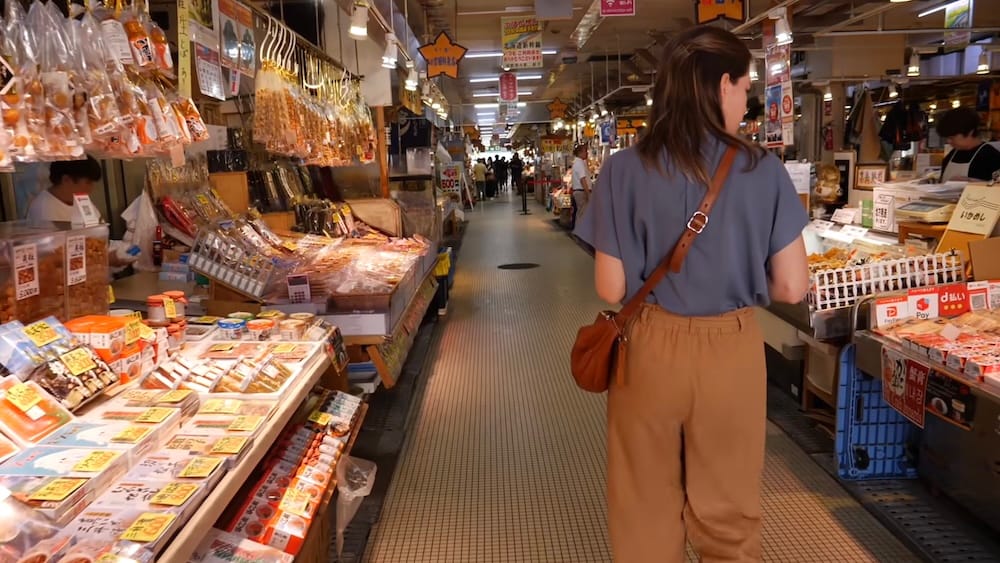
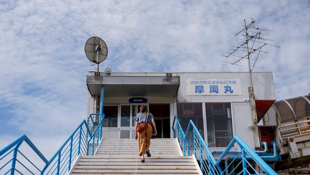
The morning market is a couple of minutes on foot from Hakodate Station, and the old ferry Mashu-maru is about five minutes away. From the ship, the Kanemori red brick warehouses are roughly ten minutes along the waterfront. We drifted through all three without much of a plan and without a great sense of direction, and nothing about that stretch gave us any trouble. Mashu-maru only turned up because we were walking around the port, a nice little stop on our way to the downtown area, which is the sort of thing you find when your feet are in charge of the route. If you’d rather walk from the station to the warehouses in one go, it’s 15 to 20 minutes, or a five- or six-minute tram to Jujigai and a five-minute walk from there.
Motomachi
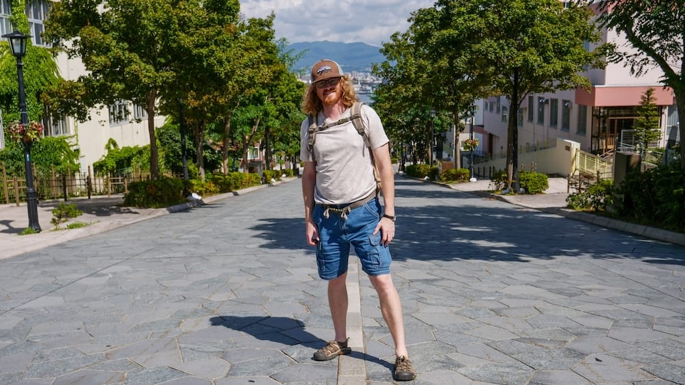
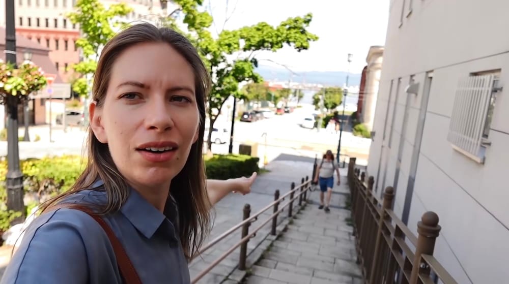
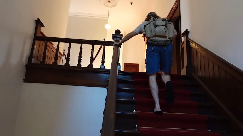
Motomachi is where the walking gets serious. It has nineteen slopes, so the hills are the neighbourhood, not one obstacle you meet at Hachimanzaka. From the Suehirocho tram stop it’s a few minutes on foot to Hachimanzaka, which has stairs beside the road. From Jujigai it’s roughly ten to twelve uphill minutes to the ropeway base, and the Orthodox church is about fifteen on foot. We climbed Hachimanzaka on a hot, humid day, and I felt every step of it.
Coming back down was a different proposition. After the ropeway and the Old Public Hall we walked through Motomachi Park, which has harbour views and made an easy route back to the waterfront.
Goryokaku Park
Goryokaku is a walk of its own. We arrived before the tower opened and wandered the park first, and what struck me was how ordinary it felt: locals out walking and jogging, school kids cycling through. It’s a beautiful place for a daily stroll, but it sits in another part of the city, and it’s where I’d stop walking and start riding.
Where the Tram Earns Its Fare
From Hakodate Station the tram to Jujigai or Suehirocho takes about five to ten minutes and costs ¥250. Goryokaku-koen-mae takes about 16 to 17 minutes and costs ¥270, plus another 10 to 13 minutes on foot to the park. Yunokawa is about half an hour and ¥290. We never went to Yunokawa, so that’s a ride time, not a review. Those fares went up in December 2025, so older guides that quote ¥210 to ¥260 are out of date.
The one-day pass is ¥800 and the 24-hour pass is ¥1,130. IC cards such as Suica, PASMO and Kitaca work, with the fare paid when you get off. By my arithmetic, three rides at ¥250 to ¥270 come to ¥750 to ¥810, so the day pass only starts to pay around the fourth ride. If you’re mostly walking the western loop you probably won’t ride enough to justify one, and if you add Goryokaku or a hotel outside the centre the sums change. The city’s transport page lists the current passes.
The Hills and the Heat
The distances in Hakodate are short, so distance isn’t what makes walking here tiring. The slope is, along with the way effort piles up when the weather is warm. Each walk in Motomachi is only a few minutes, but the district strings them together uphill.
Summer averages stay below 25°C, which sounds mild on paper. It wasn’t on the day we climbed Hachimanzaka, when the sun and the humidity made the stone slope feel like real work. Snow arrives around November and can fall as late as April, and since we only walked Hakodate in warm weather, I can’t tell you how the slopes handle ice.
What the tram gave us was a choice about where to spend our effort. We used it to get into town and kept our legs for the hills, and I’d spend it the same way again.
Which Legs to Walk and Which to Ride
Here’s the call I’d make on each leg. The rows marked “We did it” are ones we walked, and the times for the rest come from maps and timetables.
| Leg | On foot (approx.) | Tram option | My call | Basis |
|---|---|---|---|---|
| Station to morning market | About 2 minutes | Not needed | Walk | We did it |
| Station to Mashu-maru | About 5 minutes | Not needed | Walk | We did it |
| Mashu-maru to Kanemori | About 10 minutes | Not needed | Walk | We did it |
| Station to Kanemori | 15 to 20 minutes | To Jujigai in 5 to 6 minutes, then a 5-minute walk | Walk, or ride when it’s hot | Times researched |
| Suehirocho stop to Hachimanzaka | A few minutes to the foot, then the climb | To Suehirocho in about 8 to 10 minutes | Walk; it’s uphill | We climbed it |
| Jujigai to ropeway base | 10 to 12 minutes, uphill | Not applicable | Walk | Time researched |
| Ropeway to Old Public Hall to Motomachi Park to waterfront | About 10 minutes to the hall, then downhill | Not needed | Walk | We did it |
| Tram stop to Goryokaku Park | 10 to 13 minutes | 16 to 17 minutes from the station | Ride | Times researched; we walked the park |
| Station to Yunokawa | Not a walk | About 30 minutes | Ride | Researched; we didn’t go |
Where to Sleep if You Want to Walk More (or Less)
Where you sleep decides how much of all this you actually walk, and it matters more here than in most cities. A hotel near Hakodate Station puts the market and Mashu-maru a few minutes away on foot with the tram trunk right outside, which is the setup I’d look at first if your plan is the western loop, and you can compare hotels near Hakodate Station to see how close each one sits. Ours was outside the centre with both tram lines passing it. That worked because the trams run often, but it meant our days started with a ride into town, and it’s a big part of why we spent our effort the way we did.
The far end of the trunk is Yunokawa, about half an hour from the station by tram, with hot-spring hotels and the airport close by. We didn’t stay there, so I can’t tell you what it’s like to live at the end of a line that long, but if a soak matters more to you than a short walk to the market, it’s worth a look, and you can browse the hotels in Yunokawa Onsen to see what’s there. And if you’d rather see the whole map before you pick which pocket to base yourself in, browse Hakodate hotels across the city.
What I Can’t Vouch For
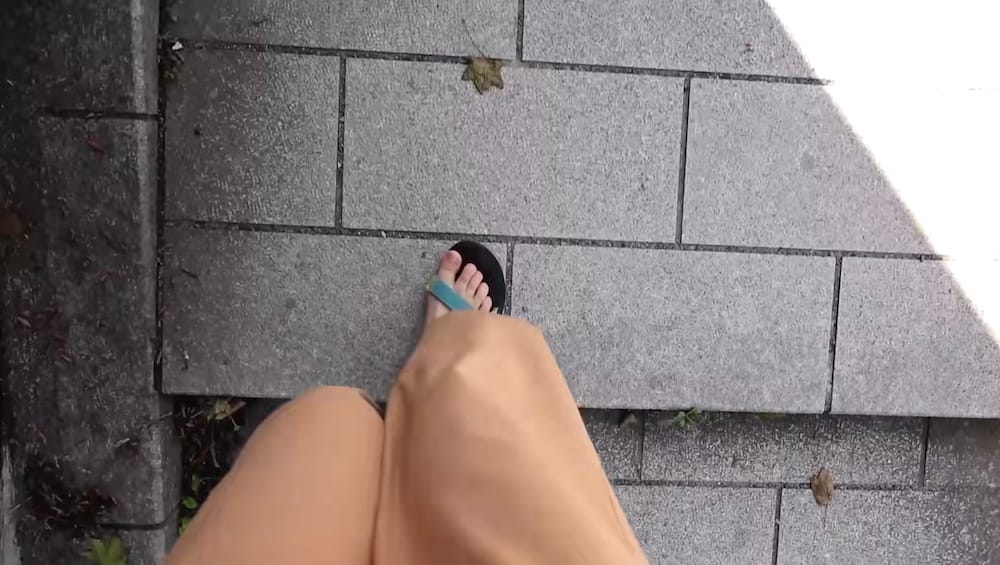
I can’t give you a verdict on walking in rain or snow, after dark, with luggage or a stroller, or for anyone with limited mobility. The slopes have stairs and the distances are short, but that isn’t the same as knowing how a particular route will suit you, so I’d check the exact walk before you commit to it. The city’s tourism site has a luggage page if bags are part of your plan.
The Rule I’d Use
Walk inside each district, and ride when you’re crossing between them or when the heat and the hills would spend energy you’ll want later. If you’re staying outside the centre, a hotel on the shared stretch of the tram gets you both lines. That’s how we did it, hot climb and all, and I’d do it the same way again.
Frequently Asked Questions
Is Hakodate walkable?
Yes, in pockets. The sights gather into a handful of areas, the station and market, the waterfront, Motomachi and the ropeway, and Goryokaku, and walking works well inside each one. Between them, and out to Yunokawa, I’d ride the tram, since each hop runs roughly half an hour door to door.
Do you need the tram to get around Hakodate?
You need it for the hops between districts, not for moving inside one. Our hotel was outside the centre with tram lines 2 and 5 running past it, so we rode into town and then walked most of the rest. The tram is what let us cover the distance without spending our legs on it.
How often do the Hakodate trams run?
In the daytime you can expect one about every seven to eight minutes on the shared stretch between Yunokawa and Jujigai, and about every fourteen minutes beyond Jujigai. Service runs from around 6:00 in the morning until roughly 11:30 at night, though I’d check the current timetable before planning around it.
How much does the Hakodate tram cost?
Fares went up in December 2025, so older guides quoting ¥210 to ¥260 are out of date. From Hakodate Station, a ride to Jujigai or Suehirocho is ¥250, Goryokaku-koen-mae is ¥270, and Yunokawa is ¥290. The one-day pass is ¥800 and the 24-hour pass is ¥1,130, and IC cards like Suica, PASMO and Kitaca work.
Is the Hachimanzaka slope hard to walk up?
The distance is short, only a few minutes from the Suehirocho tram stop, but the slope is real. We climbed it on a hot, humid day and felt every step, with stairs running alongside the road for anyone who wants them. Distance isn’t the issue in Hakodate; the hills are.
Is Goryokaku within walking distance of Motomachi and the waterfront?
Not really. It sits in a separate part of the city, and I’d treat the tram ride there, about 16 to 17 minutes from the station plus 10 to 13 minutes on foot, as a hop rather than an extension of a Motomachi walk. Once you’re at the park, walking around it is easy.
Is Hakodate walkable in the rain, in winter, or with limited mobility?
I can’t say. We only walked Hakodate in warm, dry weather, so I have no firsthand answer for rain, snow, night walking, luggage, or accessibility. The slopes have stairs and the distances are short, but that’s not the same as knowing how a specific route will suit you.
This article is also available in Spanish. [Leé la versión en castellano: ¿Se puede recorrer Hakodate a pie? Cómo fue movernos para nosotros]
This article contains affiliate links. If you book through one of these links, I may earn a commission at no extra cost to you.