
Calgary’s +15 is one of the few things we did in the city where the first ten minutes were less useful than the next two hours.
At first, the concept seems almost comically straightforward. Downtown buildings are connected by enclosed pedestrian bridges roughly 15 feet above street level. You walk inside, avoid the traffic and weather, and eventually come out somewhere else.
Then you actually try using it.
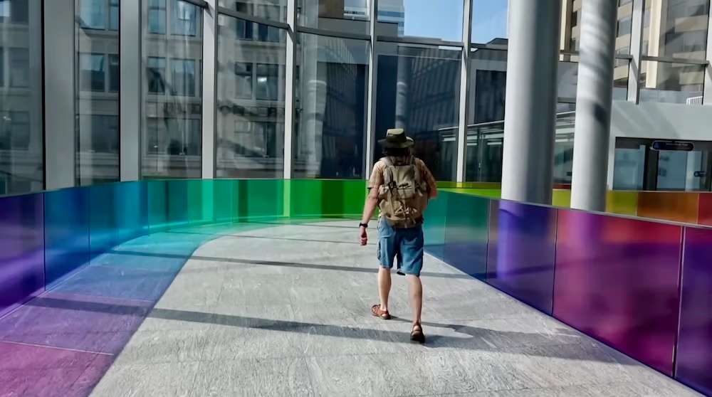
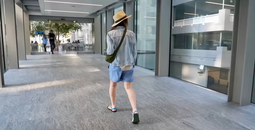
Audrey and I spent most of one summer morning exploring the +15, and it quickly became obvious that this is not one long glass hallway floating over downtown Calgary. You cross a bridge, enter an office tower or shopping complex, walk through part of the building, follow another sign, turn a corner, cross another bridge and keep going. Sometimes there is a food court. Sometimes there is public art. Sometimes you briefly wonder whether you are still following the +15 at all.
That is the key to understanding the system.
Calgary effectively has a second pedestrian layer running through its downtown buildings, and the +15 works best once you stop thinking of it as a single attraction or walkway and start treating it as another way to move through the city.
We happened to use it during hot summer weather, when the air conditioning was every bit as welcome as shelter from snow would have been in January. We liked the network enough to spend most of the morning inside, but I would not recommend blindly disappearing into it and hoping for the best. A little understanding of the map, access hours and building connections makes a big difference.
Calgary’s +15 is more than a collection of skybridges
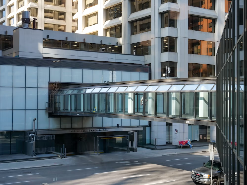
The +15 stretches for more than 16 kilometres through downtown Calgary and includes more than 80 bridges.
Those numbers give you a sense of scale, but they do not really explain what walking through it feels like.
The bridges are only part of the network. The +15 also uses internal public walkways inside connected buildings, plus the stairs, escalators, ramps and elevators that move pedestrians between street level and the elevated system.
The easiest way to picture it is:
building → bridge → building → corridor → another bridge → another building
Most of this happens around the second floor, approximately 15 feet above street level, which is where the name comes from.
Before our visit, I had pictured something more uniform: bridge after bridge after bridge, perhaps with the occasional lobby interrupting the sequence. In reality, the interior environment changes constantly because you are moving through actual downtown buildings rather than through one purpose-built tunnel.
One moment you are crossing above traffic through a glass bridge. A few minutes later you might be walking beside a restaurant or through a shopping area before the next connection appears.
That ended up being part of the appeal.
It made downtown feel layered in a way I had not experienced in many other Canadian cities. There was the Calgary we had already been exploring outside at street level, and then this second Calgary moving through the buildings above it.
The first challenge is simply figuring out how to get inside
This sounds embarrassingly basic, but I think it is the first practical problem a visitor is likely to have.
You can stand on the sidewalk, look up at one of the bridges and understand perfectly well what the +15 is while having no idea how to get onto it.
There is no central entrance. There is no ticket desk. There is no giant sign announcing that the indoor pedestrian adventure begins here.
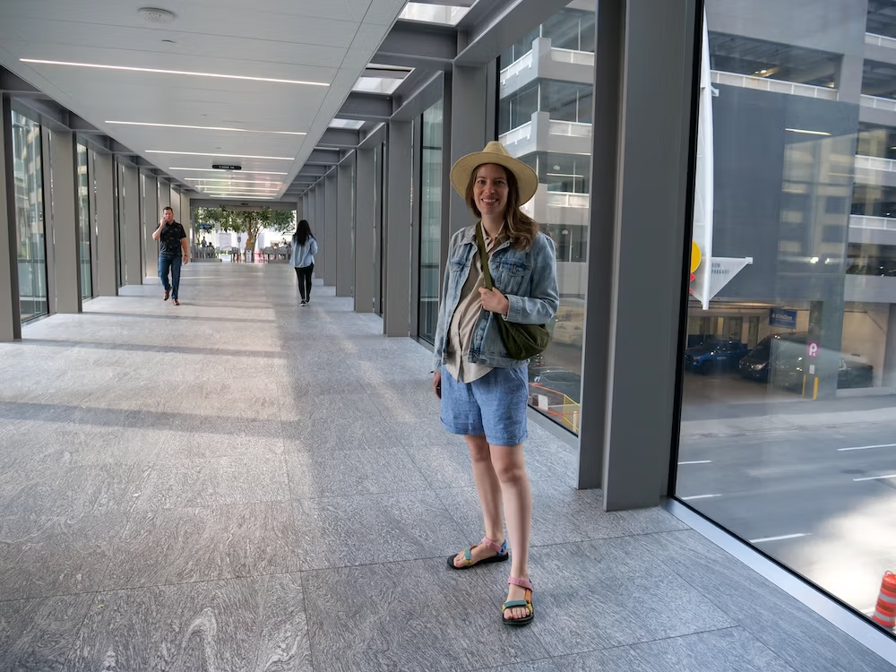
You generally enter through one of the buildings connected to the network and then use stairs, an escalator, a ramp or an elevator to reach the +15 level.
Once you know that, the system becomes much less mysterious.
I would not walk into a random tower and assume it will automatically lead somewhere useful, though. The smarter approach is to look at the map, identify a connected building close to where you already are and enter from there.
From that point, you are moving horizontally through the network rather than hunting for a mysterious standalone skywalk entrance.
We did not document the exact building where we first entered, so I am not going to manufacture a perfect first-timer route after the fact. What I would do now is much simpler: pick a clear point on the official map and begin there.
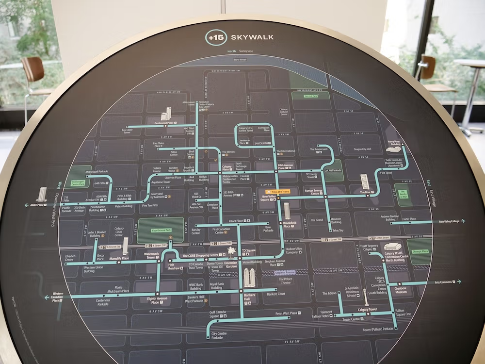
Keep the official +15 map open while you walk
I generally dislike travel advice that amounts to “look at the map.”
In this case, look at the map.
The +15 does not behave like Calgary’s street grid, where you can usually see the direction you are walking and keep moving toward the next intersection. Inside the network, you may cross a street in one direction, turn through a building interior, go around a lobby or food court and then emerge onto a bridge facing somewhere else.
You are still progressing through the network, but the physical route can feel less intuitive than the distance on a normal street map suggests.
The official Calgary +15 map is useful because it shows more than just the elevated bridges. It also marks things such as CTrain stations, shopping areas, food courts and accessibility limitations.
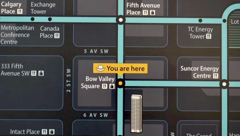
I would keep it on my phone rather than trying to memorize the network.
The signage itself is also changing. Calgary has been rolling out a redesigned wayfinding system intended to make point-to-point directions, cardinal directions and links back to transit and street level easier to follow.
That work is still underway, so you may see a mixture of older and newer signs depending on which part of the network you are walking through.
The fact that Calgary is improving the wayfinding tells you something useful in itself: if the +15 occasionally feels confusing, you have not suddenly lost the ability to walk. It is a complicated system.
We did not have some dramatic story of wandering hopelessly through an office tower for three hours, and I am not going to invent one because it would make better travel-blog theatre. We simply found that this was a network where paying attention mattered.
If you would rather make your first pass through downtown with somebody else handling the navigation, there is a current two-hour introductory walking tour of downtown Calgary that incorporates the +15 along with public art and historic downtown buildings. We did not take this tour ourselves, so I would treat it as a guided alternative rather than a personal recommendation. It makes the most sense if you want a broader introduction to downtown while learning how the elevated network fits into the city.

Spending most of a morning inside was more interesting than I expected
The +15 was not supposed to become one of the more memorable parts of our downtown sightseeing.
We started exploring it and then just kept going. Most of the morning disappeared that way.
I had expected functional corridors and enclosed bridges. Those were certainly there, but we also found restaurants, food courts, shops and public art along different sections of the route. We even saw child-oriented spaces inside parts of the network.
I would not stretch that observation into a claim that the entire +15 is some giant family attraction. It is not. But the spaces we walked through had considerably more life than the phrase “elevated pedestrian network” suggests.

Devonian Gardens shows how unusual Calgary’s indoor downtown can get
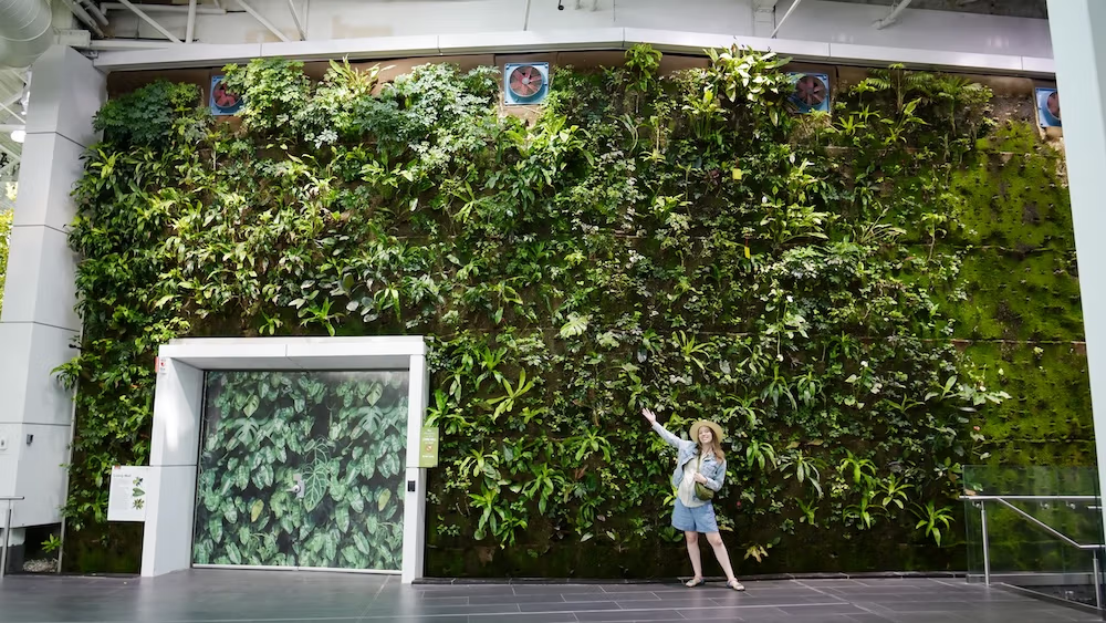
The best example came when we reached The CORE Shopping Centre. The +15 feeds into the complex, and from there you can head up to Level 4 for Devonian Gardens, which felt like a fairly dramatic change of scenery after spending the morning wandering through bridges, office buildings and commercial corridors.
We suddenly went from downtown Calgary to a space filled with greenery, ponds, fish, a huge living wall and places to sit beneath a glass ceiling. There was so much natural light coming through that the whole place had a surprisingly tropical feeling, despite the fact that we were still inside a shopping centre.
That was the part I found so unusual. I am used to cities having parks and green spaces. I was much less accustomed to finding this much greenery tucked inside a commercial building several floors above the street.
We thought it was a really neat idea, and it also reinforced something I had started noticing about the +15 by that point: exploring Calgary indoors did not necessarily mean spending hours trudging through sterile office corridors. Sometimes the system led into spaces that were destinations in their own right.
There was also a simple pleasure in moving above the streets.
Outside you have intersections, traffic, honking and emergency vehicles. Inside, you are still walking through downtown but the experience is quieter and more controlled.
At some point we were talking about how nice it was to avoid the street noise and our analysis deteriorated into an imitation of the traffic below: “beep beep.”
No urban-planning awards were won that morning.
But the point stood. The +15 made downtown feel calmer.
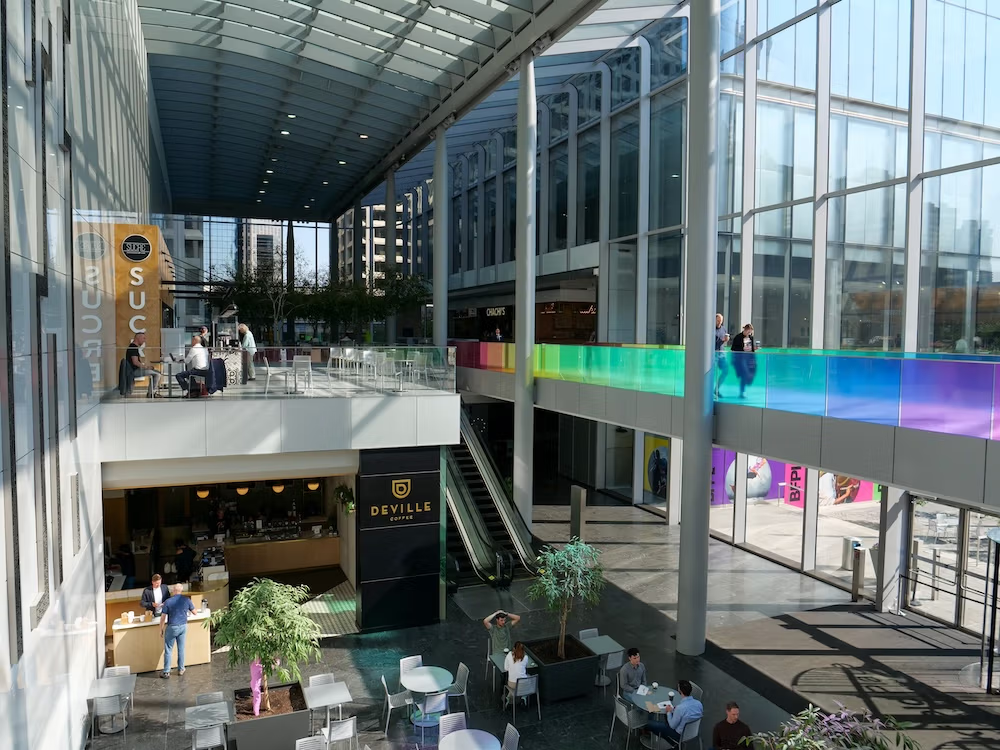
The biggest surprise for us was using the +15 in summer
The +15 is so closely associated with Calgary winters that I assumed cold weather was basically the entire story.
We were there in summer. It was hot, and the air conditioning was fantastic.
We had already been doing a lot of walking around central Calgary, so stepping into a climate-controlled network and continuing to explore without roasting outside was immediately appealing.
That changed my perception of the system.
Winter may explain much of the logic behind building weather-protected walkways in Calgary, but you do not need snow piling up against the windows for the +15 to be useful. Hot weather works too.
I would still choose the street when the weather is pleasant because Calgary was one of those cities where we genuinely enjoyed walking outside. I would not travel there and spend the entire trip inside simply because the network exists.
But on a hot afternoon, the +15 earns its keep very quickly.
03:26 – Plus 15 Skywalk
04:31 – Devonian Gardens
Where the +15 is actually useful for sightseeing
One of the easiest mistakes is to look at the size of the system and assume that practically everything downtown is connected.
It is not.
The network is concentrated through Calgary’s downtown commercial core. Current connections run around major central complexes and landmarks including The CORE Shopping Centre, Bankers Hall, the Calgary TELUS Convention Centre, the Fairmont Palliser and Calgary Tower area, City Hall and Bow Valley College.
The +15 also intersects well with portions of the CTrain corridor along 7 Avenue, which means you can combine rail and indoor walking rather than treating them as completely separate transportation systems.
That is useful. What is less useful is assuming that every attraction close to downtown is automatically part of the network.
It is possible for somewhere to be geographically nearby and still require street-level walking.
The Chinese Cultural Centre is a good example. We visited it during the same Calgary trip and walked there easily, but being close to the commercial core does not mean there is some continuous glass tunnel delivering you to the door.
The same principle applies across the city. The +15 is excellent when your destination is genuinely connected to it, and considerably less impressive when you try to force it to solve a route it was never designed to solve.
If +15 access is one of the reasons you want to stay downtown, I would choose accommodation by location and then verify the actual connection rather than assuming every property with “downtown” in its description plugs directly into the network. We did not stay at a hotel I can personally recommend specifically for +15 access, but you can compare current hotels in Downtown Calgary and then cross-check the properties that interest you against the official +15 map before booking.
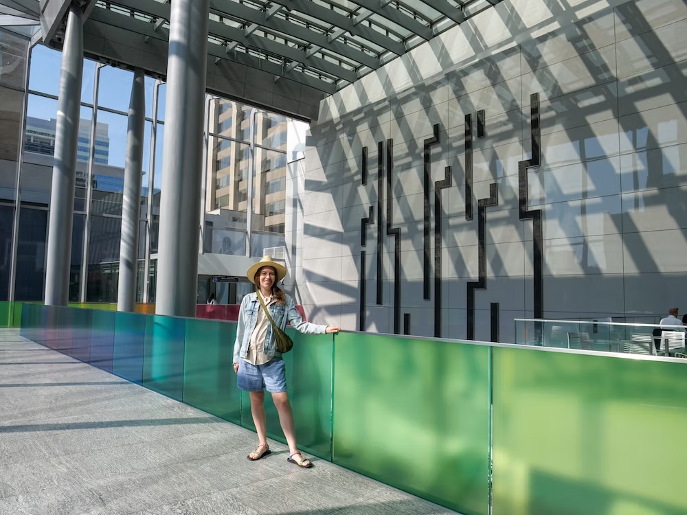
A bridge on the map does not guarantee that you can use it
This is the operational detail I would pay the most attention to.
The +15 is a public pedestrian network, but large parts of it pass through privately operated buildings. Those buildings are still part of the route, yet their access and operating conditions matter.
As of August 2026, Calgary’s standard +15 hours are:
- Monday to Friday: 6:00 am to 9:00 pm
- Weekends and statutory holidays: 9:00 am to 7:00 pm
- December 25: closed
The dangerous word there is standard.
Individual bridges and building connections can operate shorter hours. Some can close on weekends or holidays. Maintenance, construction, redevelopment or special circumstances can also break a route temporarily.
In other words, a line can exist on the map and still be useless when you arrive.
That distinction between physical connection and usable connection is the part I would remember.
If a specific indoor route matters to your plans, especially outside weekday daytime hours, check Calgary’s current +15 service information and closures before setting off.
I would especially do that if your plan depends on staying indoors for a long stretch rather than simply using one or two bridges.
And if you hit a closed connection? Go outside.
I mean that seriously. Sometimes the sidewalk for one block is a vastly better solution than trying to engineer a heroic indoor detour because you have become emotionally committed to completing the +15.
Travel has enough pointless logistical battles without inventing new ones.
Do not confuse the +15 with an entirely climate-controlled tunnel
Most of the +15 experience people imagine is weather-protected, and modern enclosed bridges are designed with heating and cooling in mind.
That does not mean every single metre of the larger network is a hermetically sealed indoor environment.
Older open-air components still exist within the system.
For most visitors, that distinction probably will not matter much on a pleasant day. It matters more if you are specifically relying on the +15 to avoid extreme weather.
Again, our own experience was during summer. The network worked beautifully as somewhere to cool down and keep walking.
We have not personally relied on it during a Calgary winter, so I would not pretend otherwise.
If you are planning a winter trip, the +15 clearly has an important role, but detailed winter strategy deserves more than me recycling a summer walk and adding snow to the description.
Using Calgary’s +15 with a wheelchair or stroller
This is another area where looking at the actual route matters more than making a broad statement about the network.
Mobility devices, service animals and baby carriages are allowed within the +15 system.
That does not mean every route is automatically step-free.
The official map identifies sections that have stairs only as well as locations where there is no elevator connection to street level.
That can make a huge difference.
If you are travelling with a wheelchair, mobility aid or stroller, I would plan the exact connection rather than simply looking at two connected buildings and assuming there will be an uninterrupted accessible route between them.
We did not test the +15 with a stroller, nor were we evaluating wheelchair accessibility during our visit, so I cannot give you a personal verdict on how smooth the experience is.
What I can say is that the map gives you enough information to avoid treating accessibility as an afterthought.
It also marks accessible washrooms throughout the network, which is the sort of practical detail that becomes considerably more interesting after you have already been walking for an hour.
When I would use the +15 and when I would stay outside
I do not think the useful question is whether the +15 is “better” than walking on Calgary’s streets.
We did both. They solve different problems.
If I were deciding again, I would look at four things.
Bad weather strongly favours the +15
Cold and snow are the obvious examples, but our experience made me add summer heat to the list.
If the weather is making street-level walking unpleasant and your destination is connected, the +15 becomes an easy choice.
Time of day can matter as much as the route
A connection that works perfectly on a weekday afternoon may not be the same experience later in the evening or on a holiday.
If you are travelling outside the most predictable daytime hours, check the current access information rather than assuming the whole network follows one schedule.
Your destination actually needs to be on the network
This sounds painfully obvious. It stops being obvious once you see how large the +15 is.
Do not assume that “downtown Calgary” means “reachable entirely through +15.”
If a destination is outside the network and the weather is decent, walking at street level may be much simpler.
Accessibility can change the best route
If stairs are a problem, or you are using a stroller or mobility aid, the shortest-looking line on the map may not be the route that actually works.
Check the elevator and stairs information first.

Is Calgary’s +15 worth exploring if you are visiting the city?
Yes, although I would not put it on the same mental list as Calgary Tower, Heritage Park or the Chinese Cultural Centre.
You do not need to conquer the +15, and you definitely do not need to spend your vacation collecting skybridges as though Calgary hands out a medal when you reach number 80.
What I would do is deliberately use it for part of a downtown day.
Give yourself enough time to cross several bridges, move through a few connected buildings and understand the peculiar rhythm of the system. Stop for food if something looks good. Notice the art. Look down at the traffic you are no longer standing beside. Then go back outside when outside makes more sense.
That is basically what happened to us, except we became interested enough that “let’s check this out” turned into most of a morning.
I would do it again.
The next time, I would simply be smarter about keeping the official map open and checking for closures before committing to a longer indoor route.
The +15 works best when you stop expecting it to function like one giant indoor sidewalk.
It is stranger than that, and much more Calgary: a second downtown woven through offices, shopping centres and glass bridges, sitting about 15 feet above the city you were already walking through.
Frequently Asked Questions
What is Calgary’s +15 Skywalk?
Calgary’s +15 is an elevated pedestrian network running through downtown buildings, with more than 16 kilometres of walkways and more than 80 bridges. The bridges are only part of it: interior corridors, stairs, escalators, ramps and elevators also connect the system.
How do you enter Calgary’s +15?
You generally enter through a building connected to the network, then use stairs, an escalator, a ramp or an elevator to reach the +15 level. I would check the official map first and choose a clearly connected building near where you already are.
Do you need a map to use Calgary’s +15?
I would keep the official +15 map open while walking. The network passes through building interiors rather than following the street grid in a simple line, and the map also marks CTrain stations, shopping areas, food courts and accessibility limitations.
What are Calgary’s +15 opening hours?
As of August 2026, standard hours are 6:00 am to 9:00 pm Monday to Friday and 9:00 am to 7:00 pm on weekends and statutory holidays, with the network closed on December 25. Individual connections can have shorter hours or temporary closures.
Can you use Calgary’s +15 with a wheelchair or stroller?
Mobility devices, service animals and baby carriages are allowed, but not every route is automatically step-free. The official map identifies stairs-only sections and places without an elevator connection to street level, so I would check the exact route before setting out.
Is Calgary’s +15 useful in summer?
Yes. We explored the +15 during hot summer weather and found the air-conditioned interiors a welcome break from the heat. We have not personally relied on the network during a Calgary winter, so our firsthand experience is specifically summer-based.
Is Calgary’s +15 worth exploring as a visitor?
Yes, but I would use it as part of a downtown day rather than treat it like a conventional attraction. We enjoyed crossing several bridges, moving through connected buildings, seeing public art and indoor spaces, and then returning to street level when that made more sense.
This guide is also available in Spanish. [Leé la versión en castellano: Guía del +15 Skywalk de Calgary: cómo funciona la red peatonal del centro]
This article contains affiliate links. If you book through one of these links, I may earn a commission at no extra cost to you.