
I think Audrey was a little nervous before we reached Sapporo. On paper it’s a city of nearly two million people, the fifth largest in Japan, and she’d half braced herself for another big, chaotic metropolis to wrestle with. That isn’t what we found. The city felt roomy and green, it was easy to read, and it moved at a pace that seemed almost unhurried for somewhere so large. By the time we left after four nights, I’d decided it was the most livable big Japanese city I’d ever visited. Every time we walked along Odori Park, I came back to the same thought: this is a city that has its priorities in order.
I’ll confess I spent those four nights admiring a city plan without having any idea it was one. I didn’t know Sapporo had been drawn on paper in a matter of years, rather than growing slowly over centuries the way Tokyo, Osaka and Kyoto did. I only learned that once we were home, and it explained almost everything we’d felt walking around. So this is the story in the order we experienced it: what we noticed first, then the history underneath it.
What We Noticed Before We Knew the History
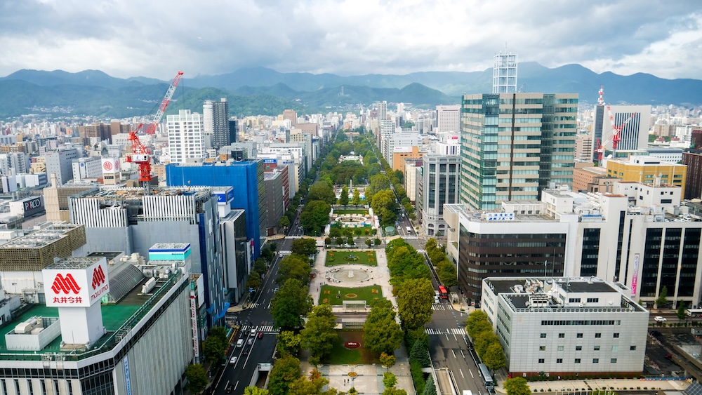
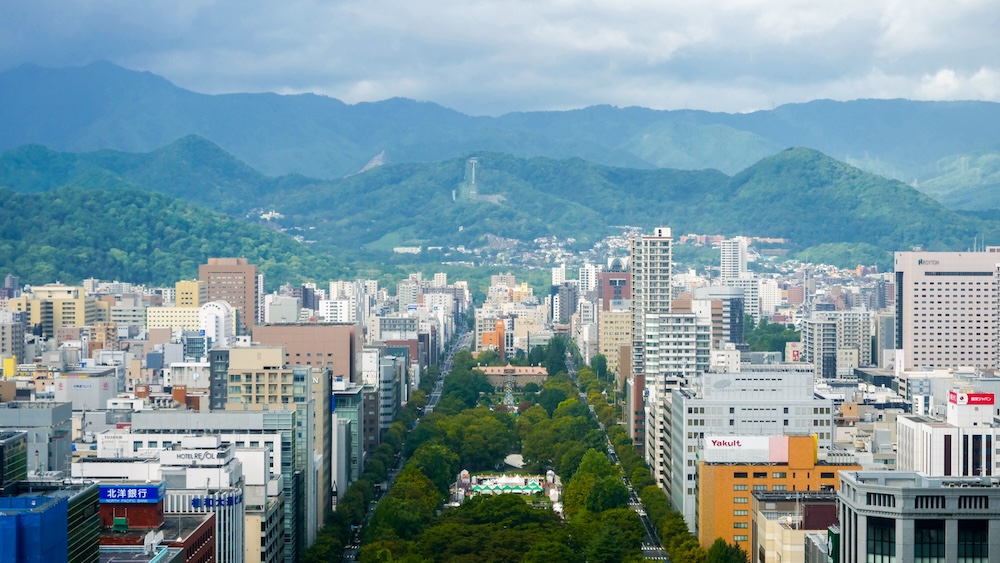
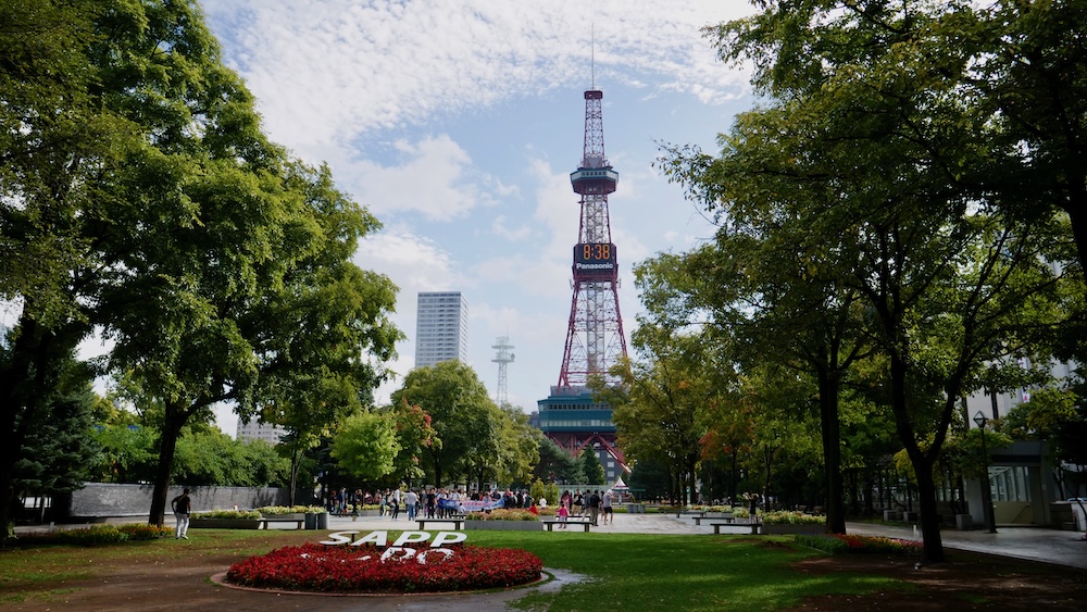
The first clue came on our first morning, from the observation deck of the TV Tower, when the thing that struck us was how spread out the city looked. At street level the impressions kept piling up. There were far more green spaces than I’m used to in a Japanese city centre, the streets ran in a tidy grid, and the city was obviously big without ever feeling insanely busy. Audrey kept coming back to how green it was, with its tree-lined avenues and parks, and to how much more room you seemed to have up north compared with Tokyo.
There was something harder to put a finger on too. As a visitor, I came away with the impression that people looked a little less stressed, and that culture and lifestyle might count for more there than simply grinding it out. That’s my read from a short stay, not a verdict on how anyone in Sapporo actually lives. Still, the feeling was strong, and it turns out a handful of very practical decisions made in the 1800s go a long way towards explaining why a visitor might walk away with it.
A Capital Drawn on Paper
Before the Meiji era, the land Sapporo now sits on was a sparsely populated plain, home to Ainu people, with a few trading posts run by the Matsumae domain. The city’s name comes from Ainu. The most common explanation is sap-poro, meaning “dry, wide,” while another theory traces it to sari-poro-pe, a large river through wetlands, describing the basin of the Toyohira River.
That changed abruptly. In 1869 the new Meiji government set up the Kaitakushi, a development commission charged with colonizing and settling the island it had just renamed Hokkaido, and the commission needed a capital. The job went to Shima Yoshitake, a former samurai from the Saga domain, who is said to have pictured the city while looking out over the Ishikari Plain from the slopes of Maruyama. That’s the same hill whose primeval forest Audrey and I wandered through one rainy afternoon a century and a half later, with no idea that someone had once stood nearby and imagined the streets below.
Shima’s plan was a grid, anchored from the start by two lines. One was a canal dug in the last years of the Edo period, which is now the Sōsei River. The other was a broad street running at right angles to it that would eventually become Odori Park. Every block was measured out from those two axes, which is why Sapporo addresses still read almost like map coordinates today. Shima didn’t stick around to see it built. He was dismissed soon afterwards, and his successor, Iwamura Michitoshi, carried the plan forward from 1871.
Who Really Designed the Grid?
Read enough about Sapporo and you’ll run into the claim that American advisers designed the grid, which supposedly explains why the city feels a bit North American. It’s a neat story, but the real one is better. Shima drew directly on Kyoto’s ancient go-board street plan and its ordering of the city, with government to the north and commerce to the south. His plan was underway at least two years before any American expertise turned up.
The Americans did come, and they mattered a great deal. In 1871 Kuroda Kiyotaka, a senior figure at the Kaitakushi, recruited Horace Capron, the US Commissioner of Agriculture, as the commission’s chief adviser. Kuroda looked to the United States because it had a similar climate and long experience settling frontier land. Historians argue that American planning ideas and experts went on to shape how the city developed. The fairest way to put it is that the grid was a Japanese plan borrowed from Kyoto, while the American influence shows up in how Sapporo grew and, most obviously, in the buildings that went up along those straight streets.
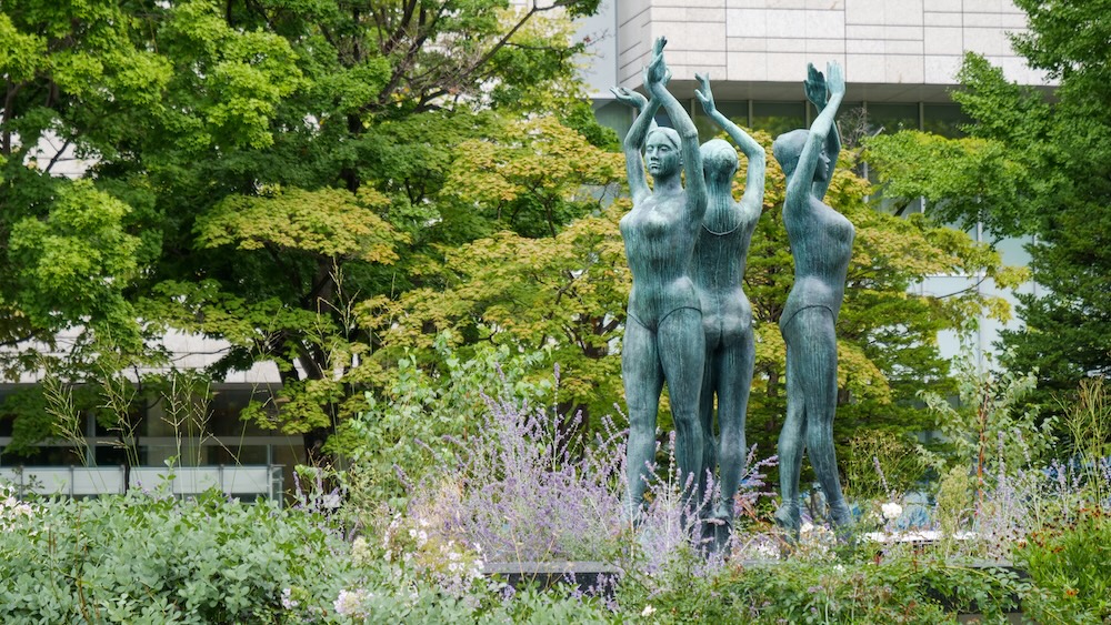
Odori Park: The Firebreak That Became the City’s Front Lawn
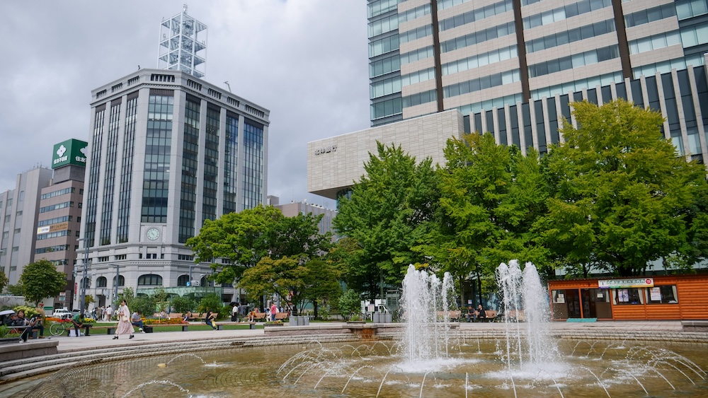
Odori Park was the place that really made me fall for Sapporo. We treated it as a corridor, cutting through on the way somewhere else, and as a destination in its own right. A city that hands a long strip of its downtown over to lawns and trees struck me as one that values something more than squeezing every square metre for profit.
The real reason it’s there is more practical than that, and I like it even more for it. In 1871 a huge firebreak was laid out through the middle of the new city, separating the government district to the north from the townspeople’s homes and shops to the south. In a young city built of wood, stopping a fire in the merchant quarter from jumping into the government offices was a serious concern. The strip was 58 ken wide, about 105 metres, which is an astonishing amount of empty land to leave in the heart of a brand-new capital.
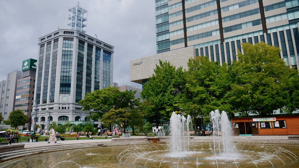
It didn’t stay bare for long. In 1872 it was named Shiribeshi-dōri, after one of Hokkaido’s provinces, and in 1881, when the city switched to the numbered jō and chōme street system, it became Ōdōri, which simply means “big street.” Western flowers went in during the 1870s. In 1909 the city brought in Nagaoka Yasuhei, a leading landscape designer from Tokyo, to turn it into a proper promenade. During the Second World War it was dug up and farmed, and the occupation forces even built a church on it before it was restored as a park. Today it runs about 1.5 kilometres, covers roughly 7.8 hectares and holds about 4,700 trees of some 90 species.
So the feature that convinced me Sapporo had its priorities in order started life as fire insurance and a line between officials and everyone else. Generations of residents then chose to keep it green instead of building on it, which, to my mind, makes the point even better.
We pieced this history together only after we got home, which is the slow way to do it. If you’d rather have someone point out the planning story while you’re standing in it, one current small-group walk is built around exactly this. It lasts about three hours with no more than six people, starting at the TV Tower and covering Odori Park’s role in Sapporo’s city planning, then heading along the Sōsei River, through Tanukikoji and into the underground walkway before finishing at the red-brick government office. I haven’t done it myself, and it’s close to 10,000 steps, but if the history is what draws you, you can check dates for the city-centre history and art walk.
Why Sapporo’s Oldest Buildings Look American
The architecture was one of the things I found most fascinating about Sapporo, just as I had in Hakodate earlier on the same trip. Tucked among the modern towers are wooden and brick buildings that look as though they’ve been lifted from a small American college town, and they tell the second half of the city’s origin story.
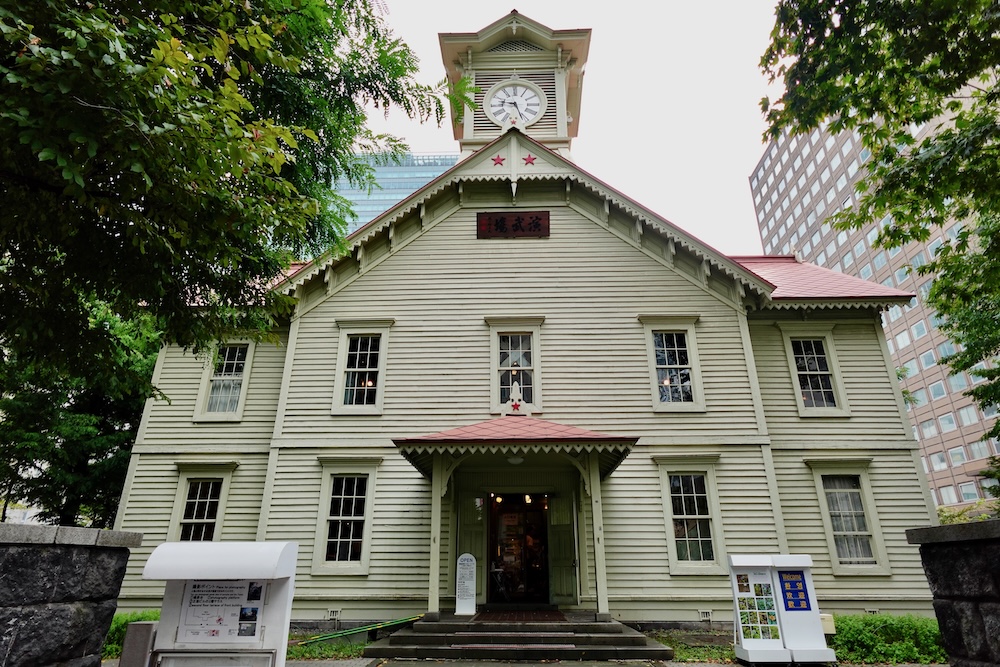
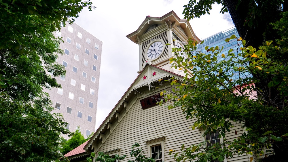
The Sapporo Clock Tower, a couple of blocks’ walk from the TV Tower, was built in 1878 as a military drill hall for Sapporo Agricultural College, which later became Hokkaido University. The college’s first vice-president was William S. Clark, president of Massachusetts Agricultural College, who introduced military training to the curriculum. His successor, William Wheeler, planned the drill hall. Kuroda then proposed adding a large clock, which was ordered from E. Howard & Co. of Boston and installed in 1881. It’s said to be the oldest building in the city, and its American look is entirely intentional.
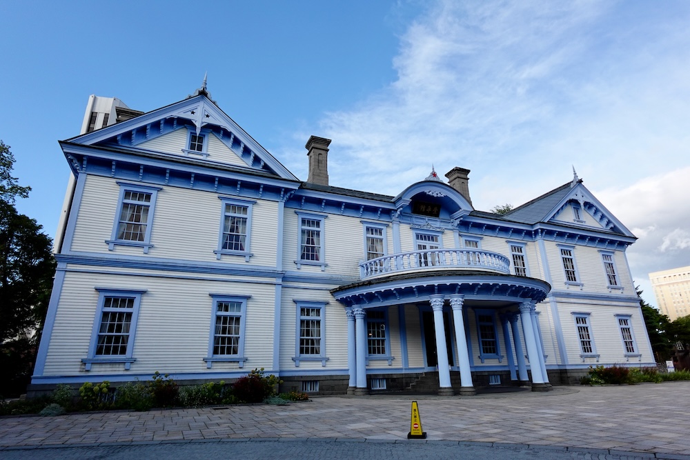
Hoheikan, which we visited in Nakajima Park, follows the same thread. The Kaitakushi built it in 1880 as a Western-style hotel under its own management, and its first overnight guest was Emperor Meiji in 1881. It originally stood near today’s TV Tower and was moved to Nakajima Park in 1958, where it spent decades as a municipal wedding venue before reopening after restoration in 2016. It’s described as the oldest surviving wooden hotel building in Japan. We found the interior a bit bare and didn’t stay long, which makes more sense once you know how many lives the place has lived.
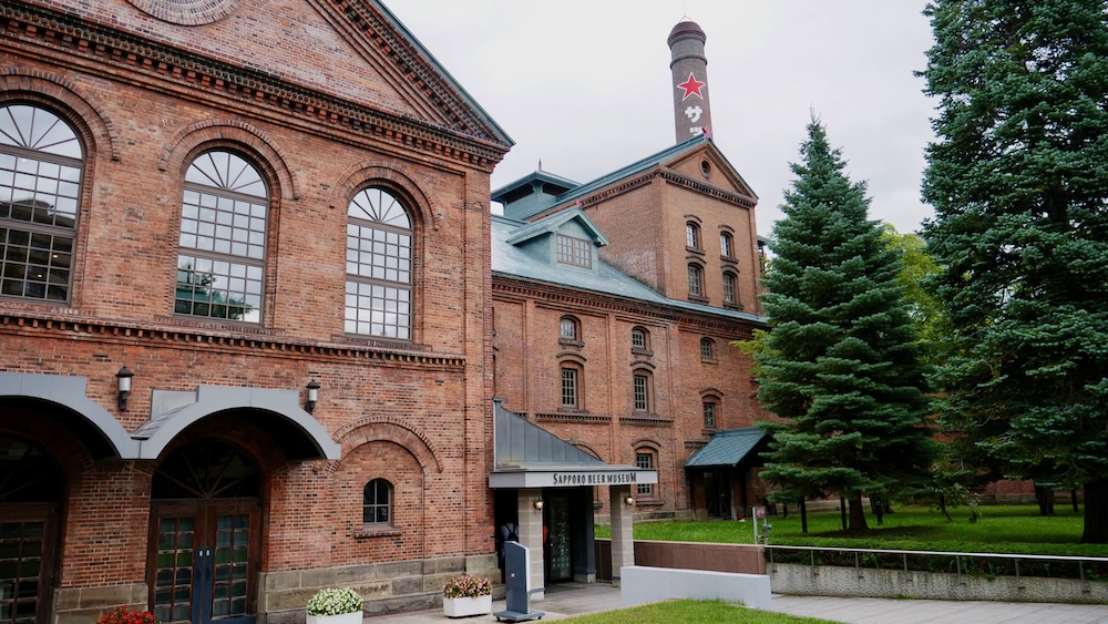
The red-brick Sapporo Beer Museum belongs to the same chapter, because the Kaitakushi founded a brewery in 1876 as one of its many development projects. The grandest building of the era is one we didn’t go inside: the Former Hokkaido Government Office, nicknamed Akarenga, or “red brick.” It was completed in 1888, housed Hokkaido’s government for about 80 years until 1968, and reopened in July 2025 after a long renovation and earthquake-proofing. Put these buildings together and you can see why parts of central Sapporo feel unlike anywhere else in Japan. The grid underneath was Japanese, but a lot of what was built on top of it was shaped with American help.
We saw the Clock Tower and Hoheikan on our own, a stop here and there between other things. If you’d like to string the frontier landmarks together in a single morning with someone explaining them, another current small-group walk covers the TV Tower, the Clock Tower and the red-brick government office over about two hours and roughly 3.2 km. You can see the guided walk past Sapporo’s historic landmarks.
Room to Breathe: Space, Parks and a Ring of Green
The sense that Sapporo was big without being frantic turns out to be measurable. Here’s how the city stacks up against central Tokyo:
| Sapporo (city) | Tokyo (23 special wards) | |
|---|---|---|
| Population | About 1.96 million | About 9.8 million |
| Area | About 1,121 km² | About 627 km² |
| Population density | About 1,750 people per km² | About 15,700 people per km² |
| Origin of the city plan | Drawn up from 1869 | Grew out of Edo over centuries |
Those headline numbers exaggerate the gap a little, because Sapporo’s city limits take in large stretches of mountain forest to the south, so its built-up neighbourhoods are denser than the citywide figure suggests. Even allowing for that, central Sapporo carries a fraction of central Tokyo’s crowding, and after a night in Tokyo at the start of our trip, the difference was obvious from the moment we started walking around.
The green part of the story was more nuanced than I expected. Sapporo has more than 2,700 city parks, by some counts the most of any city in Japan, helped along by a 1970s drive to build a hundred new children’s parks. Its park space per resident sits near the top among Japan’s major cities. Yet the city’s own planning documents admit that the central Chūō Ward is badly short of small neighbourhood parks, because most of downtown was built over before planned park-making got going. That changed how I understood what we’d felt. The green we kept noticing downtown didn’t come from a park on every block. It came from a handful of big, deliberate spaces like Odori and Nakajima Park, the forest at Maruyama on the city’s edge, and street trees that have lined Sapporo’s avenues since the Meiji era.
The city has carried on thinking about green space on a grand scale. Under a plan called the Circular Greenbelt Concept, Sapporo set out to ring its urban area with parks and green belts. One of the boldest results is Moerenuma Park, which we didn’t get to, built on top of a former landfill. The sculptor Isamu Noguchi drew up its master plan in 1988, shortly before he died, and the park was finished in 2005. Turning a rubbish tip into a park designed as one giant sculpture feels very much in character for a city that began as an empty firebreak.
How the 1972 Winter Olympics Shaped the Modern City
If the 1800s gave Sapporo its bones, the 1972 Winter Olympics gave it a lot of the modern plumbing that keeps it feeling orderly. These were the first Winter Games ever held in Asia, and the city had waited a long time for them. It had originally been awarded the 1940 Games, which were cancelled because of the war.
The first subway line, the Namboku Line, opened in December 1971, about two months before the Games. Sapporo’s trains run on rubber tyres, which make them noticeably quieter and smoother than a typical metro. That’s a small thing, but it matched the calm we felt riding around the city. The underground shopping streets linking the centre, Pole Town and Aurora Town, opened a month earlier, in November 1971, to take pressure off the crowded streets above. Sapporo also became one of Japan’s designated cities in 1972. A surprising amount of what made the city feel so easy to us, from a quiet subway to a centre you can cross without dodging traffic, comes out of that short burst of Olympic building.
How Sapporo Took Shape: A Short Timeline
| Year | What happened |
|---|---|
| 1869 | The Kaitakushi is founded and Shima Yoshitake plans a grid capital |
| 1871 | The Odori firebreak is laid out and Horace Capron is recruited as adviser |
| 1876 | William S. Clark arrives at the agricultural college and the Kaitakushi founds a brewery |
| 1878 | The drill hall that became the Clock Tower is built |
| 1880–81 | Hoheikan is built, the Boston clock is installed and the jō and chōme street system is adopted |
| 1888 | The red-brick Former Hokkaido Government Office is completed |
| 1909 | Odori is redesigned as a promenade |
| 1958 | Hoheikan is moved to Nakajima Park |
| 1971–72 | The subway and underground shopping streets open, and Sapporo hosts the Winter Olympics |
| 2005 | Moerenuma Park is completed on a former landfill |
Seeing Sapporo Differently Once You Know
If we go back to Sapporo, I’ll see it with different eyes. That broad green strip through downtown is a 105-metre line drawn in 1871 to stop fires. The tidy grid owes more to Kyoto than to any American engineer. The wooden buildings that look like they belong on an American campus are there because Americans helped build the college and institutions they housed. Even the hush of the subway goes back to the rush to get ready for the 1972 Olympics.
If you want to experience that history on foot, it helps to stay close to it. The Clock Tower, the TV Tower and the red-brick government office all sit within an easy walk of Odori, so a base around the park puts the old frontier core right outside your door. You can compare hotels within walking distance of Odori Park if that’s how you’d like to explore it.
None of that changes what we felt, but it explains it. Audrey’s relief at how manageable the city turned out to be, and my sense that Sapporo has its priorities in order, both make sense once you know the place was designed with space, order and greenery built in from the start, and that later generations chose to protect those things when they could easily have paved over them. Knowing that now, I’m a little embarrassed that I spent four nights admiring a city plan without realising it was one, and I’m already looking forward to walking those straight streets again with the history in my head.
Frequently Asked Questions
Why does Sapporo feel different from other big Japanese cities?
Sapporo was deliberately planned as a modern capital beginning in 1869, rather than developing over centuries like Tokyo, Osaka or Kyoto. Its orderly street grid, broad Odori Park corridor, tree-lined avenues and later transport infrastructure help explain why Audrey and I found such a large city surprisingly spacious and manageable.
Was Sapporo’s street grid designed by Americans?
No. Shima Yoshitake developed the original grid in 1869, drawing on Kyoto’s traditional street layout. American advisers arrived later, beginning with Horace Capron in 1871, and influenced the city’s subsequent development and institutions. The original grid was a Japanese plan, not an American import.
Why is Odori Park so wide?
Odori Park began as a firebreak in 1871, separating the government district to the north from residential and commercial areas to the south. The original strip was about 105 metres wide. It gradually became a landscaped public space and now forms a long green corridor through central Sapporo.
Why do some historic buildings in Sapporo look American?
American advisers and educators helped develop several institutions during Sapporo’s early years. The Clock Tower was built in 1878 as a drill hall for Sapporo Agricultural College, while Hoheikan was constructed in 1880 as a Western-style hotel. Their architecture reflects that influence, even though the city’s original street plan drew on Kyoto.
Is Sapporo really less crowded than Tokyo?
The citywide population density figures are substantially different: roughly 1,750 people per square kilometre in Sapporo compared with about 15,700 in Tokyo’s 23 special wards. However, Sapporo’s boundaries include extensive mountain forests, so those figures exaggerate the difference between built-up areas. We still found central Sapporo noticeably less overwhelming during our visit.
How did the 1972 Winter Olympics change Sapporo?
Preparations for the Games accelerated major transport improvements. The Namboku subway line opened in December 1971, while the Pole Town and Aurora Town underground shopping streets opened the previous month. The rubber-tyred subway and pedestrian connections are part of the modern infrastructure that made Sapporo feel easy for us to explore.
Can you explore Sapporo’s historic city centre on foot?
Yes. The Clock Tower, TV Tower and Former Hokkaido Government Office are within an easy walk of Odori Park. We explored several of the central landmarks independently, although guided historical walks are also available for visitors who want an explanation of the city’s planning and early development.
This article is also available in Spanish. [Leé la versión en castellano: ¿Por qué Sapporo se siente tan diferente? La historia de sus calles y su diseño urbano]
This article contains affiliate links. If you book through one of these links, I may earn a commission at no extra cost to you.