
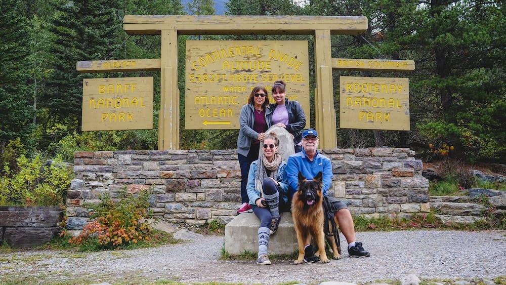
Somewhere on the Banff–Windermere Highway, between Windermere Lake and wherever we were headed next, a sign appeared on the shoulder that most drivers probably blow past without a second thought. We didn’t. We pulled over, got Togo out for a stretch while Audrey’s sister kept hold of his leash, and stood next to a plain roadside marker that turned out to be more interesting than it had any right to look.
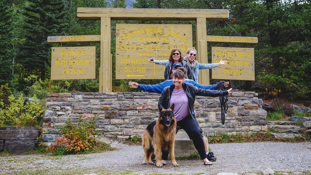
If you’re driving this stretch of Highway 93 between Banff and Kootenay National Parks and wondering whether the Continental Divide sign is worth the stop, the answer is yes, not because there’s much to look at, but because of what standing there actually means.
What You’re Actually Looking At
The stop sits at Vermilion Pass, right on Highway 93 as it climbs out of Castle Junction on its way toward Kootenay National Park, about 29 kilometres from Banff townsite and 27 kilometres from Lake Louise, depending on which direction you’re coming from. There’s no visitor centre, no gift shop, nothing that announces itself as a destination. Just a sign, a pull-off, and mountains and forest in every direction.
Three Things That Line Actually Divides
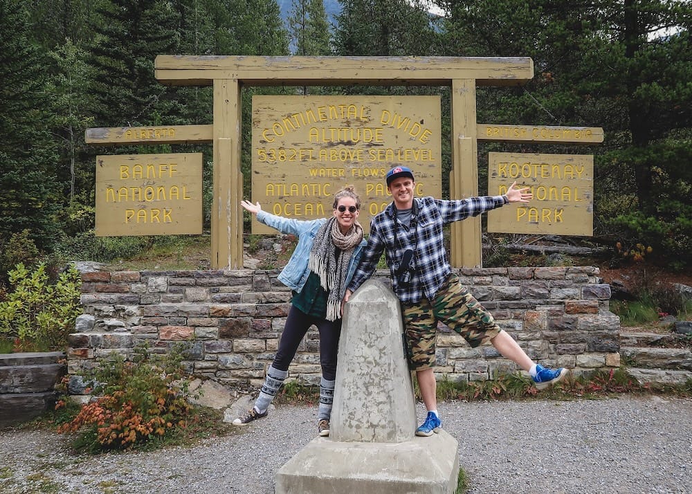
We stood at the sign and worked through it out loud, and it holds up: that one line does three separate jobs at once.
| Divide | West Side | East Side |
|---|---|---|
| Province | British Columbia | Alberta |
| National Park | Kootenay National Park | Banff National Park |
| Watershed | Flows to the Pacific Ocean | Flows to the Atlantic, via Hudson Bay |
The last one is the part that actually made us stop talking for a second. Rain and snowmelt on the British Columbia side eventually make their way to the Pacific. Cross that line, and the water is bound for the Atlantic instead, funneled north through Hudson Bay on a route you’d never guess just by looking at the mountain in front of you.
The sign itself makes the point as much visually as it does in words: provincial flags planted on either side, a Canadian flag positioned right at the dividing line, and a survey marker sunk into the ground so the whole thing feels less abstract and more like an actual spot you can stand on. It’s a small, deliberate bit of staging for what is otherwise just a bend in a mountain highway, and it works.
The Burned Forest You Pass on the Way
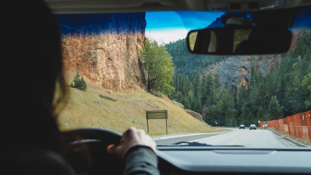
For the better part of an hour before we reached the pass, we’d been driving through forest in visibly different states of recovery, some of it fully regrown, some younger and thinner, and stretches where the trees were still charred and bare. It turns out we were passing through the aftermath of two separate fires. A lightning-caused blaze tore through the area immediately west of the divide back in 1968, and lodgepole pine, one of the first species to reclaim burned ground, was still visibly reasserting itself decades later. Further south, a second fire in 2003 started the same way, several lightning strikes that eventually merged and burned all the way up to the treeline. Driving through all of that right before hitting the Continental Divide sign gave the whole stretch a strange, layered feeling: geological boundary lines invisible under the tires, and the visible scars of fire recovery playing out on either side of the road at the same time.
Is It Worth Stopping?
Yes. Not because it’s scenic in the way Banff’s lakes are scenic, and not because you’ll spend long there. It’s worth it because it turns something you’d otherwise just read about, a border, a park boundary, a watershed split, into something you can physically stand on and photograph. We got our photos, let Togo sniff around for a minute, and were back in the car in short order, but it stuck with us more than a few longer stops did. Surrounded by mountains and forest on a genuinely scenic stretch of road, it’s an easy, low-effort addition to a day already spent driving between Banff and Kootenay.
Getting There: Elevation, Parking and What to Expect
Vermilion Pass sits at roughly 1,680 metres above sea level, a bit higher than the number we guessed out loud on camera that day, though we were in the right neighborhood. You don’t need to plan around this stop. It’s accessible directly from pull-offs right on Highway 93 at the summit, with no separate fee beyond the standard Parks Canada pass required to be in either national park in the first place. There’s no facility to speak of and nothing to book in advance. You drive up, you stop, you read the sign, and you keep going.
If you’re continuing west past the divide, Radium Hot Springs is the small town waiting at the other end of this drive, and a reasonable place to base yourself if you’re not looping back to Banff the same day. You can compare current accommodation options in Radium Hot Springs if that fits your route. And if you’d rather have someone else handle the driving between parks entirely, guided day trips running this same corridor make a point of stopping at the Great Divide along the way, so you can check current availability for a Kootenay National Park day trip that covers this exact stop.
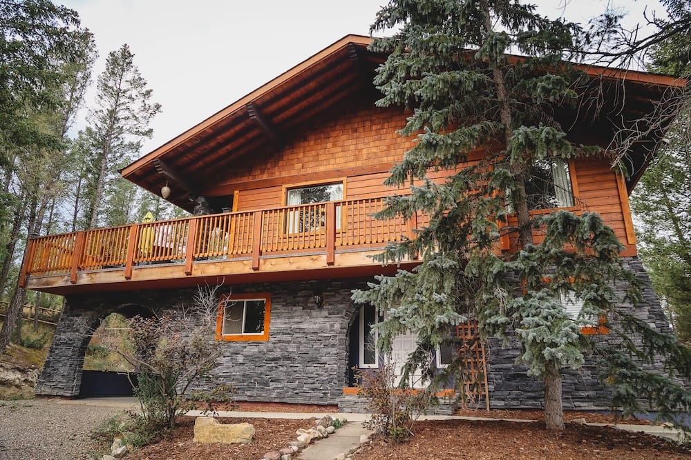
On that same road trip, we’d based ourselves a little further south in a rented chalet in Invermere, close enough to Radium Hot Springs to make Kootenay National Park an easy few days rather than a single rushed pass-through.
Frequently Asked Questions
What is the Continental Divide between Banff and Kootenay?
It’s a roadside marker at Vermilion Pass on Highway 93 that marks three boundaries at once: the Alberta–British Columbia provincial border, the Banff–Kootenay National Park boundary, and the hydrological divide between water flowing to the Pacific Ocean and water flowing to the Atlantic via Hudson Bay.
Is the Continental Divide worth stopping for?
Yes. It’s not scenic in the way Banff’s lakes are, and you won’t spend long there, but it turns an abstract geographic concept into something you can physically stand on and photograph. It’s an easy, low-effort addition to a day already spent driving between Banff and Kootenay.
How high is Vermilion Pass?
Roughly 1,680 metres above sea level.
Do I need a park pass to stop here?
Yes, the standard Parks Canada pass required to be in either Banff or Kootenay National Park. There’s no separate fee for the stop itself.
Why is there burned forest near the Continental Divide?
This stretch of Highway 93 passes through the site of two historical fires: a lightning-caused blaze in 1968 immediately west of the divide, and a second fire in 2003 further south that merged from multiple ignition points and burned up to the treeline. The forest along the drive shows different stages of recovery from both.
Where should I stay if I’m continuing into Kootenay National Park?
Radium Hot Springs sits at the other end of this drive and works well as a base. We stayed a little further south in Invermere on the same road trip, which was also close enough to make Kootenay National Park an easy few days rather than a rushed pass-through.
Can I visit the Continental Divide as part of a guided tour?
Yes. Guided day trips running the Banff–Kootenay corridor make a point of stopping at the Great Divide along the way.
This article is also available in Spanish. [Leé la versión en castellano: Continental Divide entre Banff y Kootenay: ¿vale la pena parar?]
This article contains affiliate links. If you book through one of these links, I may earn a commission at no extra cost to you.