
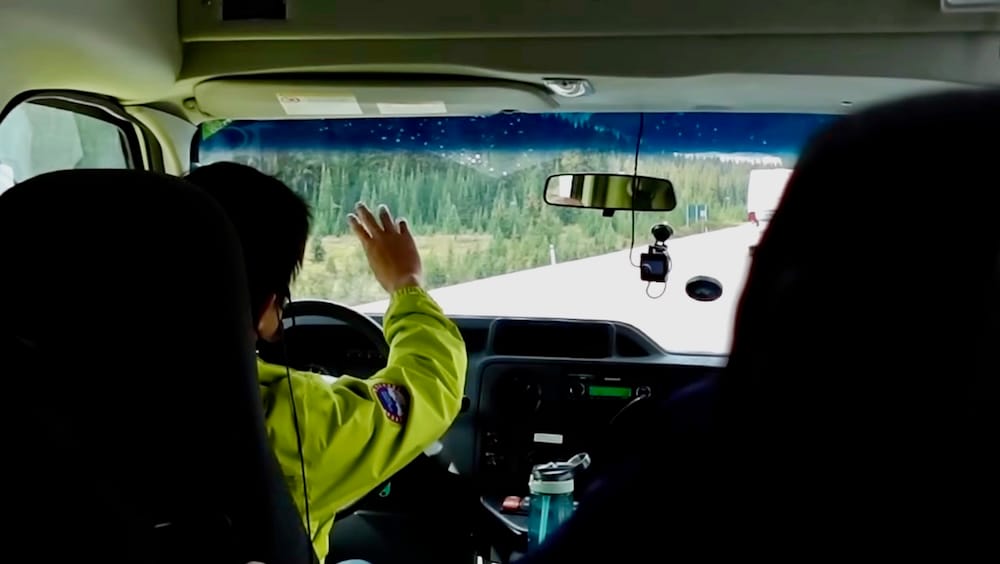
Somewhere between Bow Lake and the base of the Athabasca Glacier, our guide mentioned, almost in passing, that he’d already seen sun, rain, cloud, and snow that same day. We still had two hours of driving ahead of us before we’d find out whether that pattern would hold.
That’s the real planning problem with a one-day trip up the Icefields Parkway to Columbia Icefield. The question isn’t which lake photographs best — it’s how much of this corridor you can realistically stop for, and in what order, when you don’t control the two variables that actually decide your day: how much daylight you have, and what the mountains do with it. We did the whole route as a guided day trip from Banff, out to the Icefield and back, and by the end of it, the drive out and the drive back barely resembled the same road. This isn’t a review of that tour, and it isn’t a guide to what happens once you reach the ice itself — those are their own decisions, with their own trade-offs. What follows is the drive itself: what’s actually worth stopping for between Banff and Columbia Icefield, roughly how much time each piece costs you, and why I’d build in more flexibility than a fixed stop list usually allows.
How Much of Your Day This Drive Actually Takes
Banff to Columbia Icefield is about 185 kilometres one-way — roughly 55 kilometres to Lake Louise on the Trans-Canada Highway, then another 125 or so up Highway 93N, the Icefields Parkway itself. Driven straight through with no stops, that’s somewhere between two hours and fifteen minutes and two and a half hours each way, which puts the driving alone at four and a half to five hours for the round trip. Add any stop worth getting out of the car for, plus however long you spend at the Icefield, and a full day — six to eight hours, door to door — is a realistic target rather than an exaggeration.
You’ll need a Parks Canada pass to drive this stretch, whether you’re behind the wheel yourself or riding in a tour vehicle that already includes it. As of this writing, the daily adult rate sits at $12.25, with a family or group rate of $24.50 for up to seven people in one vehicle — though Parks Canada has also run free-admission windows in some recent years, so it’s worth checking current rates before you go rather than assuming last year’s numbers still apply.
If you’re renting a car for the trip, it’s worth locking one in before you land rather than hoping for a good rate at the counter — you can compare current rental car options at Calgary’s airport ahead of time, since availability tightens fast in peak season. If you’d rather not do the driving yourself, a similar small-group day tour departs from Banff and covers this same stretch — Bow Lake, Peyto Lake, and the Columbia Icefield — in one bookable day, close to what we did ourselves; you can check current availability for a small-group tour from Banff covering the same route.
Every Stop Between Banff and the Icefield, In Order
Heading north from Banff, the stops worth knowing about come in a fairly consistent order, though not every one demands a full pull-over.
Herbert Lake comes first, tucked in close to the Lake Louise junction, small and usually quiet enough to miss if you’re not looking for it. We didn’t stop there ourselves, and if you’re tight on time, most people don’t — it’s a nice-if-convenient photo rather than a destination in its own right.
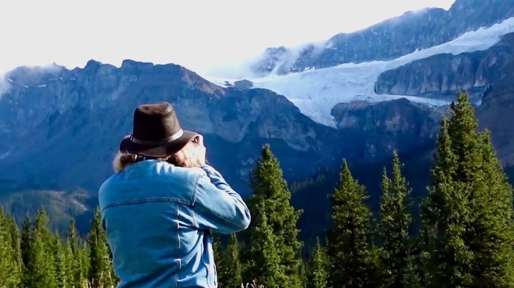
Crowfoot Glacier Viewpoint follows, a paved pull-off with a clear view up at the glacier clinging to the mountain above, its icefield split into what’s still called three claws even though the lowest one melted away decades ago. We actually visited this one on the way back rather than the way out — proof, it turned out, that you don’t have to hit every stop in the exact order the map suggests.
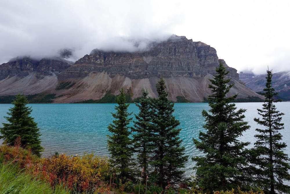
Bow Lake was our first real stop on the parkway, and it’s the kind of turquoise that looks almost fake in photos — the color that first-time visitors to this stretch of the Rockies tend to notice before anything else. I’ve written a full breakdown of what to expect there, from parking to timing to whether the Bow Glacier Falls trail is worth adding to your stop, so I won’t repeat all of it here. The short version: budget fifteen to thirty minutes unless the falls trail is calling you, in which case add roughly three hours.
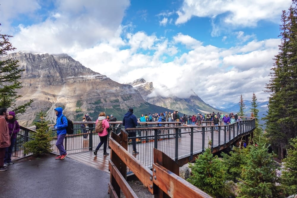
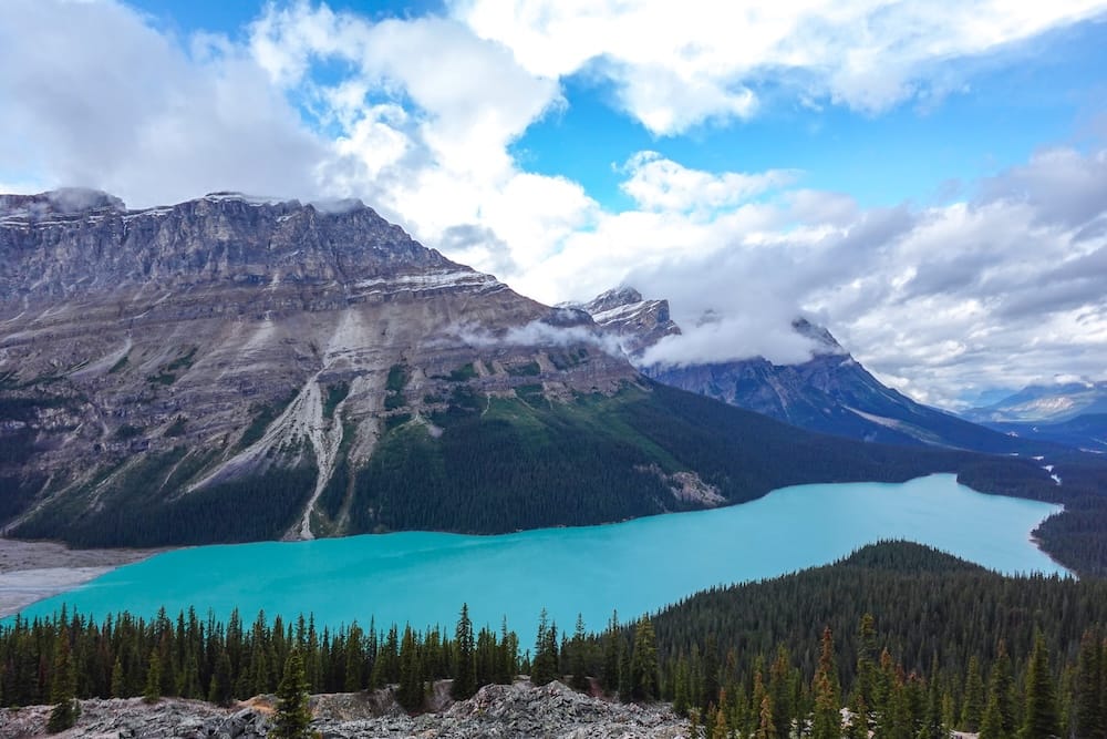
A few minutes further on, at Bow Summit, is Peyto Lake — the more dramatic of the two, and the stop where our own reactions escalated the fastest that day. If Bow Lake earned an appreciative pause, Peyto Lake earned something closer to outright astonishment. It has its own guide too, if you want the full picture of the viewpoint, the walk up, and what makes that color read as even more saturated than Bow Lake’s.
Past Bow Summit, the parkway runs by Waterfowl Lakes, a quieter and considerably less-hyped roadside stop, and then Mistaya Canyon, where a short, steep downhill walk leads to a footbridge over a narrow, churning gorge. It’s worth the legs if you have them, though there aren’t any barriers along the rocks, so watch your footing if the ground is wet.
Saskatchewan River Crossing comes a good two-thirds of the way into the drive, and it matters for a reason that has nothing to do with scenery: it’s the only place to buy gas or food between Lake Louise and the Icefield. Fill up in Banff or Lake Louise if you can, because prices here run higher, and this is genuinely your last chance until you’re much closer to Jasper.
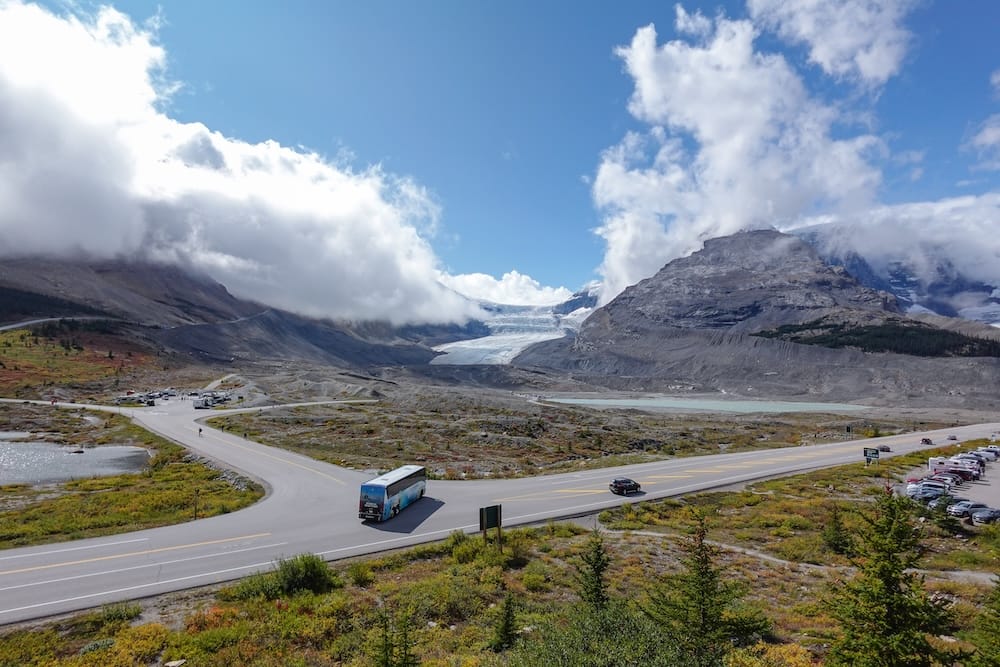
Closer to the Icefield, the road climbs sharply through a stretch known as the Big Bend, where a pull-off lets you look back down at the highway cutting through the valley — a brief stop, but a genuine sense of how much elevation you’ve gained without necessarily feeling it from inside the car. Not far past that, the Parker Ridge trailhead offers a proper hike for anyone with an extra two hours: about five kilometres round trip, with real elevation gain, for a view over the Saskatchewan Glacier that most day-trippers skip entirely. Then, finally, comes Columbia Icefield itself — its own decision, with its own trade-offs, and one that deserves a guide of its own rather than a few closing lines here.
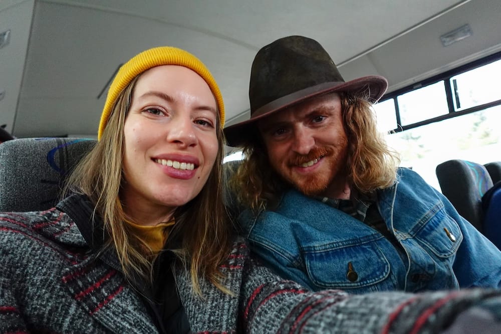
Why the Drive Back Looked Nothing Like the Drive Out
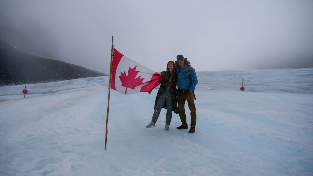
Once we were down on the ice itself aboard the Ice Explorer, the weather turned completely — what had been a cool, cloudy morning became a full snowstorm, with low visibility, wind, and snow coming sideways, the kind of cold that stops being an inconvenience and starts being the whole story. That part of the day is its own story, one I’ve told in more detail elsewhere; what matters here is what happened on the way home.
We stopped at Crowfoot Glacier Viewpoint on the way back, and by then the sun had come out completely. Mountains that had been buried in cloud and rain that morning were suddenly fully visible, and the same road, the same general stretch of parkway we’d half-seen a few hours earlier, looked like an entirely different day. Our guide, who’d clearly watched this pattern play out before, mentioned that he’d already experienced sun, rain, cloud, low visibility, and snow, all within that single shift.
I can’t promise you’ll get a swing that dramatic, but this corridor gains real elevation fast, and elevation like that tends to make its own weather regardless of what the forecast said in Banff that morning. In practice, that means if a stop looks disappointing on the way out because of cloud or rain, it’s worth reconsidering on the way back rather than writing it off completely. We only understood how good some of these viewpoints could look because we happened to loop back through one of them at a different hour, under a completely different sky.
What to Prioritize If You’re Short on Time
If you’re not doing all of this, here’s how I’d rank it, based on what we saw and what the distances say about how much of your day each stop actually costs.
| Stop | Approx. distance from Banff | Why it matters | Priority |
|---|---|---|---|
| Bow Lake | ~94 km | The corridor’s first genuinely striking water color; short stop, big payoff | Must-stop |
| Peyto Lake / Bow Summit | ~99 km | The most dramatic viewpoint on this stretch, minutes past Bow Lake | Must-stop |
| Saskatchewan River Crossing | ~135 km | Your only fuel and food stop on the entire segment | Must-stop (for fuel, not scenery) |
| Crowfoot Glacier Viewpoint | ~87–91 km | Quick roadside glacier view; easy to fold into either leg of the drive | Worth it if time allows |
| Mistaya Canyon | ~130 km | A short, active stop if you want to get out and stretch your legs | Worth it if time allows |
| Big Bend viewpoint | ~170 km | A dramatic sense of the elevation you’ve gained; brief stop | Worth it if time allows |
| Parker Ridge trailhead | ~175 km | A real hike, only for those with two extra hours and the legs for it | Worth it if time allows (with extra time) |
| Herbert Lake | ~85 km | Convenient and quiet, but visible enough from the road without stopping | Skip if behind schedule |
| Waterfowl Lakes | ~110 km | Pleasant, but not distinctive next to Bow Lake and Peyto Lake | Skip if behind schedule |
None of this replaces checking current road and parking conditions before you go — a stop that’s an easy five-minute pull-off in July can look very different after an early snow. But if I were doing this drive again with a single day to spend, I’d protect Bow Lake and Peyto Lake without question, budget properly for Saskatchewan River Crossing because you genuinely need it, and leave enough slack in the schedule to double back on whatever the weather ruined the first time through. The corridor doesn’t owe you good light on the way out. Sometimes it saves it for the way home.
Frequently Asked Questions
How long does it take to drive from Banff to Columbia Icefield?
The drive itself covers about 185 kilometres one-way and takes roughly two hours and fifteen minutes to two and a half hours without stopping, which puts the round trip at four and a half to five hours of driving alone. With stops and time at the Icefield, a full day of six to eight hours is realistic.
Can I do Banff to Columbia Icefield as a one-day trip?
Yes. We did the whole route as a guided day trip from Banff, out to the Icefield and back, and were still done with time to spare that evening. It makes for a long day, but it’s entirely achievable if you budget for the driving time plus stops.
Do I need a Parks Canada pass to drive the Icefields Parkway?
Yes, whether you’re driving yourself or riding in a tour vehicle that already includes it. As of this writing, the daily adult rate is $12.25, with a family or group rate of $24.50 for up to seven people, though Parks Canada has run free-admission windows in some recent years, so it’s worth checking current rates before you go.
What are the best stops between Banff and Columbia Icefield?
Bow Lake and Peyto Lake are the two stops I’d protect without question. Saskatchewan River Crossing matters for a practical reason rather than scenery, since it’s the only fuel and food stop on the whole segment. Crowfoot Glacier Viewpoint, Mistaya Canyon, the Big Bend viewpoint, and the Parker Ridge trailhead are all worth it if you have time to spare.
Which stops can I skip if I’m short on time?
Herbert Lake and Waterfowl Lakes are the two I’d skip first if the schedule is tight. Both are pleasant, but neither is distinctive next to Bow Lake and Peyto Lake, and Herbert Lake is visible enough from the road that stopping isn’t essential.
Is the weather reliable along the Icefields Parkway?
Not really, and that’s the biggest planning lesson from our own trip. We had a cloudy, rainy morning on the way out, a full snowstorm once we reached the Icefield, and clear sun by the time we looped back through Crowfoot Glacier Viewpoint on the return leg. This corridor gains elevation fast, and that tends to make its own weather regardless of the morning forecast.
Where can I get gas or food along the way?
Saskatchewan River Crossing, roughly two-thirds of the way into the drive, is the only place to buy gas or food between Lake Louise and the Icefield. I’d fill up in Banff or Lake Louise first, since prices there run higher.
Should I drive myself or take a guided tour?
Both work for this route. We went with a guided small-group tour from Banff, which took care of the driving and the Parks Canada pass. If you’d rather be behind the wheel yourself, renting a car and driving it independently is entirely doable within the same one-day timeframe.
This guide is also available in Spanish. [Leé la versión en castellano: Icefields Parkway de Banff al Columbia Icefield: mejores paradas para un viaje de un día]
This article contains affiliate links. If you book through one of these links, I may earn a commission at no extra cost to you.