
The first time I lived in Edmonton, I barely understood it.
In the early 2000s, I moved there from Gold River, a small village on Vancouver Island, to study at the University of Alberta—or the U of A, as everyone calls it. Edmonton was the first big city I had ever lived in, and the adjustment was equal parts exciting and overwhelming.
My first university class had more students than my entire high school.
The city stretched farther than I could wrap my head around. The winters demanded a whole new wardrobe. West Edmonton Mall felt large enough to require survival rations and a compass. I was introduced to sushi, Thai, Indian and Korean food for the first time.
Edmonton is where I became a full-fledged foodie. It is where my tastebuds evolved.
Frankly, my tastebuds were given a better education than my brain.
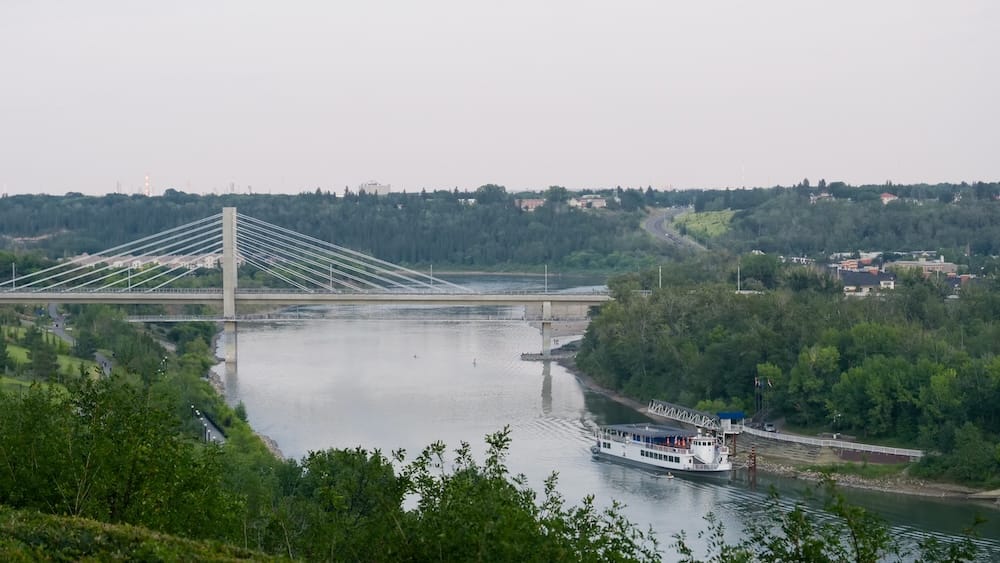
I remember Edmonton as a bit rough and tumble but very cultural. It had hockey, independent shops, festivals, sprawling neighbourhoods and an international food scene that was far more diverse than anything I had known growing up. It also had the North Saskatchewan River valley, where I could go jogging, walking or inline skating whenever the city started feeling like too much.
Then I left.
By the time Audrey and I returned nearly twenty years later, I had travelled through roughly 75 countries. I genuinely was not sure I would ever make it back to Edmonton, so the return meant more to me than I expected.
The city had changed enormously. New LRT lines reached places I could not remember accessing by train. A funicular now carried people down the riverbank. Rogers Place and the ICE District occupied a part of downtown that felt nothing like the hockey Edmonton of my student years.
Yet Edmonton remained strangely familiar.
It felt like a second hometown—not where I grew up as a child or teenager, but where I matured as a young adult. Being away for so long made it easier to see how much the city had developed. It also made me realize how much I had changed with it.
Edmonton’s own transformation stretches much further back than my time there. Its story is commonly reduced to a few tidy stages: fur-trade fort, railway town, provincial capital, oil city.
The reality is messier.
It begins long before the Edmonton name, in a river valley that had already connected people for thousands of years.
The river was here first
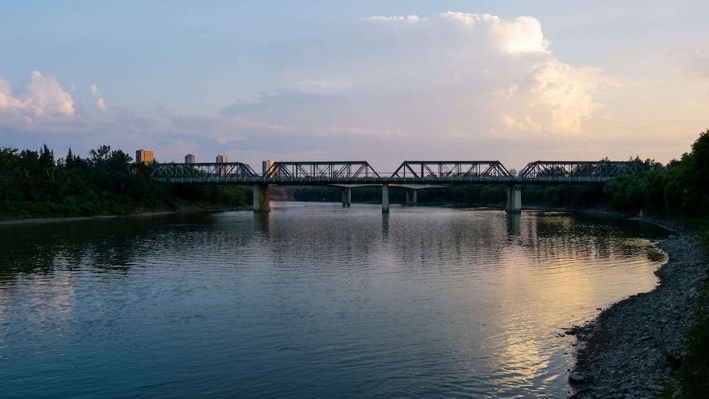
The North Saskatchewan River is the one feature that links every era of Edmonton’s history.
Long before Europeans established trading posts, the river valley was a place of travel, trade, ceremony, diplomacy and gathering. The area around today’s Rossdale Flats sits where the territories and histories of several Indigenous peoples meet, including nêhiyawak or Cree, Métis, Dene, Anishinaabe or Saulteaux, Nakota Sioux and Niitsitapi or Blackfoot communities.
People did not suddenly discover the usefulness of this location in 1795.
The river connected communities across an enormous region. Its flats offered water, relatively level ground and a practical place to meet, camp, trade and cross. Trails converged here well before roads, railways or bridges appeared.
Indigenous place names also existed long before the colonial name Edmonton. One associated with the area is amiskwacîwâskahikan, often translated as Beaver Hills House. Spellings and English translations vary, which is a reminder that Indigenous geography does not always fit neatly into the naming conventions later imposed on it.
Even the English name of the North Saskatchewan River carries traces of an older understanding of the water, deriving from a Cree expression connected to its fast current.
When I was a student, I did not think about any of this while jogging through the river valley. To me, the trails were simply my escape from classes, work and city noise.
On our return, Audrey and I walked there again. The trail system had expanded, but the basic contrast remained intact: a major city sitting above an unexpectedly deep, green corridor.
I once thought of the river valley as Edmonton’s oversized backyard.
It is closer to being the spine of the entire city.
Fort Edmonton never stayed in one place
The European fur trade entered a landscape where trade and movement were already well established.
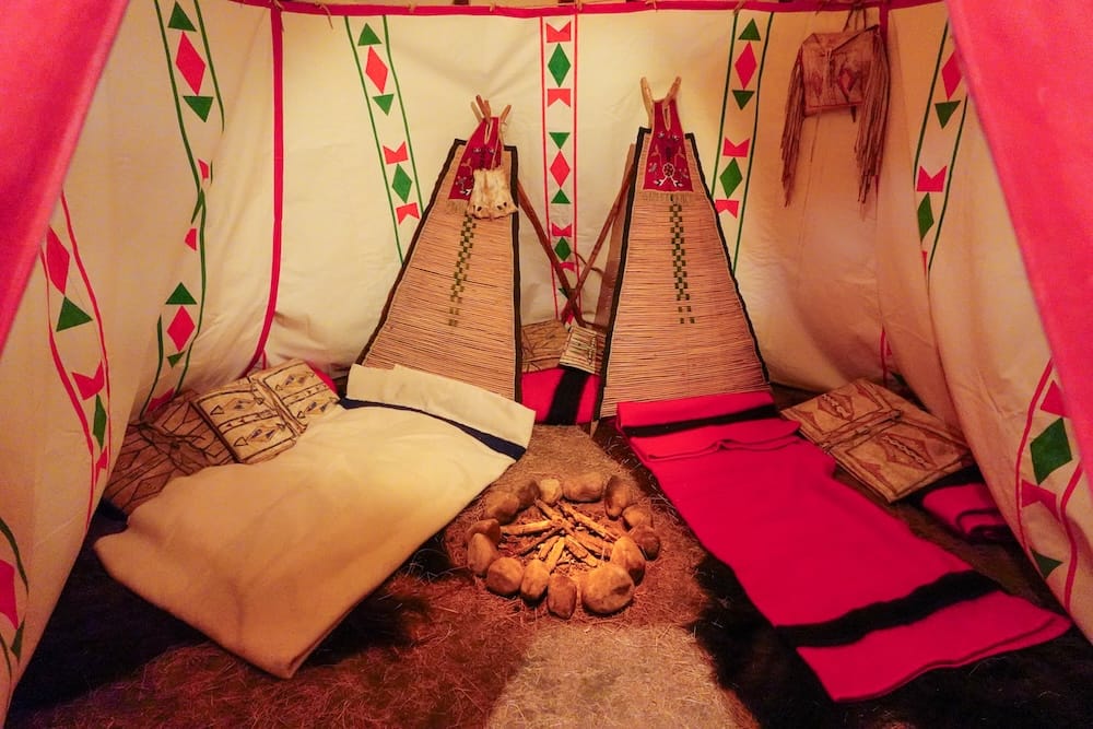
In 1795, the North West Company built Fort Augustus and the Hudson’s Bay Company established Edmonton House nearby. These first competing posts were located closer to present-day Fort Saskatchewan than modern downtown Edmonton.
They did not remain there.
The posts moved several times as the companies chased better access to transportation, trade and resources. In 1802, they relocated to the Rossdale Flats, bringing the fur-trade operations into the river-crossing landscape below present-day downtown.
Flooding eventually made that low ground less attractive. In 1830, the final Fort Edmonton was built on higher land near the site of today’s Alberta Legislature.
Fort Edmonton was therefore not one permanent wooden fort that slowly turned into a city. It was a travelling commercial operation whose name followed it from one river location to another.
That name came from Edmonton in England, associated with the birthplace of Hudson’s Bay Company official Sir James Winter Lake. A British place name was attached to a trading post, travelled with it through several relocations and eventually became the name of the settlement.
The process sounds almost casual when condensed into a few dates. The consequences were not.
The expanding fur trade and settler economy altered older relationships to the land. Treaty 6 was signed in 1876, followed by an adhesion at Fort Edmonton in 1877. Treaty 6 remains an ongoing relationship involving rights and obligations, not a completed nineteenth-century transaction that can be mentioned once and then quietly left behind.
The experience of the Papaschase First Nation is part of Edmonton’s urban history as well.
Chief Papaschase and his families made the Edmonton area their home during the nineteenth century and signed the 1877 adhesion. Their later history included delayed reserve surveying, inadequate land allocation, starvation, intense pressure from incoming settlement and the loss of land and legal status through processes that Papaschase descendants continue to contest.
The Papaschase First Nation maintains that the reserve surrender and its consequences were unjust and remain unresolved.
That matters because Edmonton did not expand across unused land. Its growth was connected to the displacement of people already living there.
After Canada acquired Rupert’s Land, the settler community grew east of the Hudson’s Bay Company reserve, around Jasper Avenue. Edmonton became a town in 1892 and a city in 1904, when its population had risen beyond 8,000.
By then, another city was forming across the river.
Edmonton and Strathcona were once rivals
The railway arrived from Calgary in 1891 but stopped on the south bank of the North Saskatchewan River.
Rather than crossing directly into Edmonton, it created a terminus on the opposite side. Businesses, hotels, warehouses and homes gathered around it. The settlement became known as South Edmonton, then the town of Strathcona in 1899 and finally the City of Strathcona in 1907.
For a time, Edmonton and Strathcona were two separate cities staring at each other across a difficult river valley.
Strathcona had the railway terminus. Edmonton had the larger commercial centre and would soon gain provincial-capital status. Both wanted residents, investment, transportation links and influence.
The river made the location valuable, but it also made daily integration awkward. Ferries and earlier bridges helped, though crossing still took effort. The two cities were neighbours without functioning as one place.
They amalgamated on February 1, 1912.
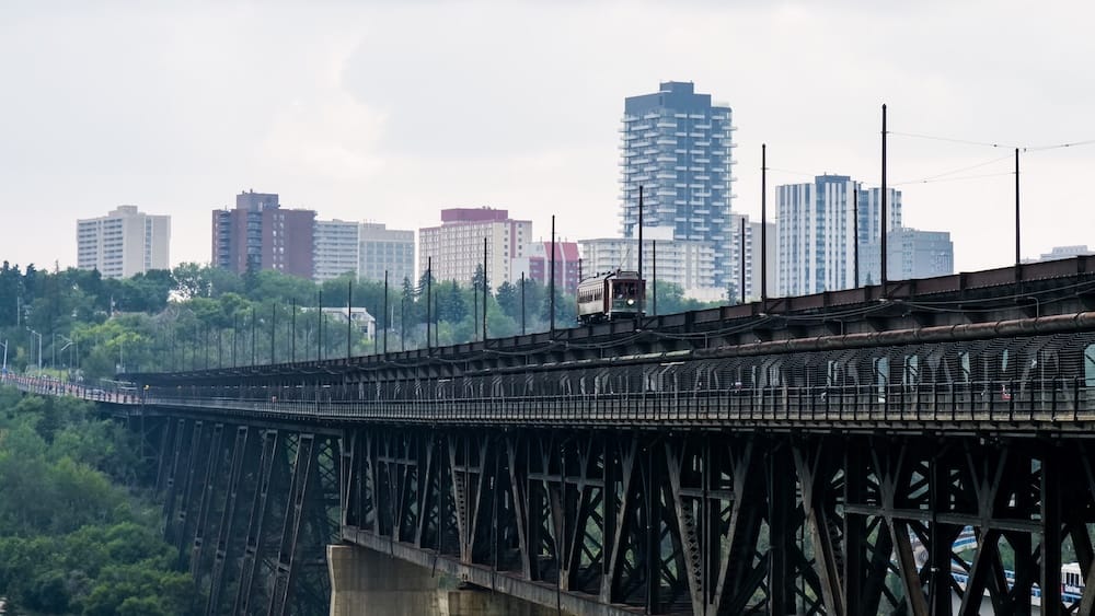
The High Level Bridge, built between 1910 and 1913, made that merger considerably more practical. It carried trains, streetcars, automobiles and pedestrians across the river, physically connecting the former rivals.
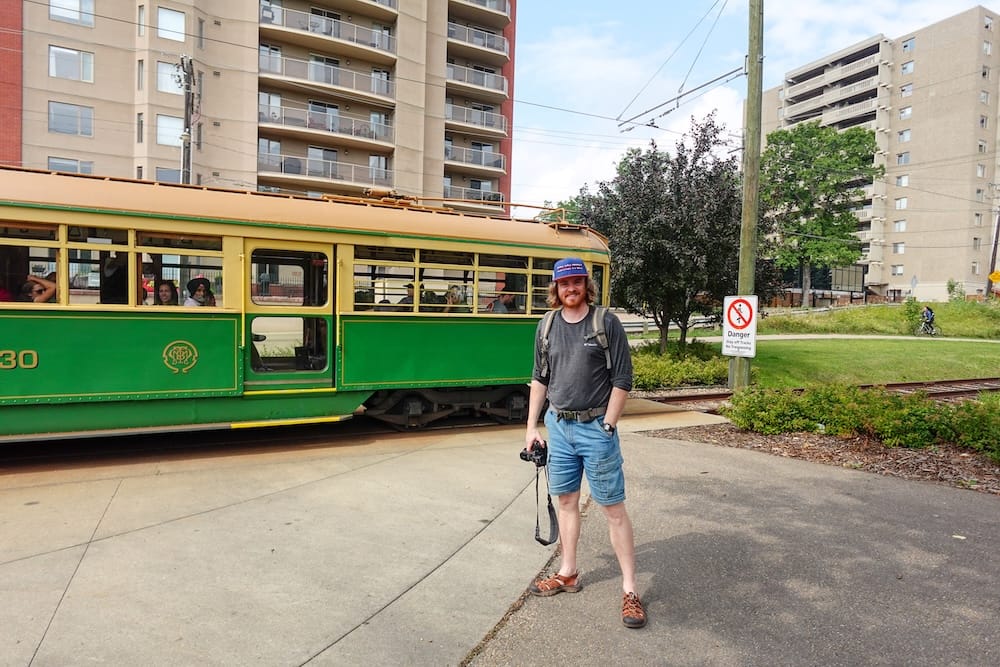
More than a century later, Audrey and I crossed the bridge aboard the High Level Bridge Streetcar.
I had seen the streetcar during my Edmonton years but never ridden it. Living somewhere has a funny way of convincing you that local attractions will remain available forever. Returning as a visitor finally got me onboard.
The ride took us toward Old Strathcona, where the old municipal divide is still easy to feel.
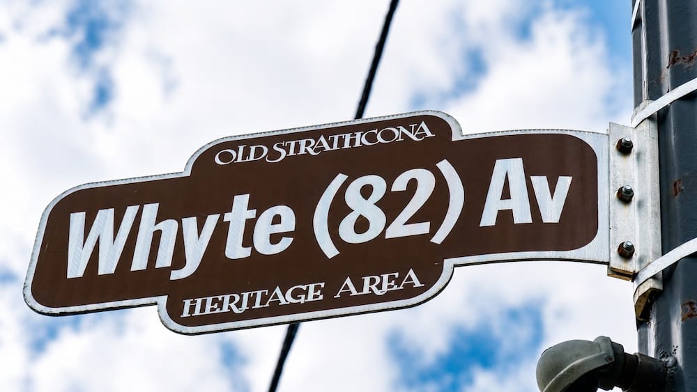
Whyte Avenue does not resemble an interchangeable extension of downtown. Its low-rise brick buildings, independent businesses, theatres, shops, restaurants and festival culture reflect the separate city that developed around the railway.
Many surviving buildings in Old Strathcona’s historic commercial core were constructed between 1891 and 1914. Slower redevelopment after amalgamation helped preserve structures that might otherwise have disappeared.
That gave the south side a historical advantage nobody would have celebrated at the time: falling behind helped it keep more of its old character.
Whyte Avenue was an important part of my university-era Edmonton. When I returned, I described it to Audrey as the city’s cultural lifeblood. That may not be an official designation, but it captures how I have always felt about the area.
For Audrey, who was visiting Edmonton for the first time, seeing Whyte Avenue changed her perception of the city.
The difference between downtown and Old Strathcona is not just atmosphere. It is the lingering outline of two cities that became one without ever becoming identical.
Edmonton did not automatically become Alberta’s capital
When Alberta became a province in 1905, Edmonton was named the temporary capital.
Temporary capital is not quite as impressive as permanent capital. It is closer to being told you have the job while the committee continues interviewing candidates.
Calgary, Red Deer and even Banff appeared in proposals or discussions about where the permanent seat of government should be located. Alberta’s first provincial election produced a large Liberal majority, and attempts to move the capital elsewhere failed during the first Legislature.
Edmonton kept the job.
It is tempting to produce one tidy explanation for why. Edmonton had political influence, a growing population and access to developing northern agricultural regions. Yet the surviving record does not reduce the decision to one heroic advantage.
Capital status came through political choices. Those choices could have gone differently.
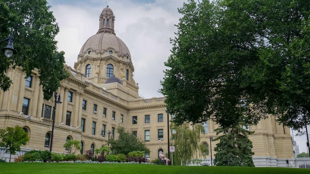
Alberta’s first Legislature opened in March 1906 inside the Thistle Rink. Members later met at McKay Avenue School while the province prepared a permanent home for its government.
Construction of the Alberta Legislature began in 1907. The building officially opened in September 1912.
Its location above the river gave the new province a suitably imposing symbol. It also placed the government near the site of the final Fort Edmonton and directly above the older river-crossing landscape.
Audrey and I toured the Legislature on our return trip. We only managed to get in because another pair cancelled, opening the final two spaces.
The building is grand, but its location tells the more interesting story. Indigenous gathering ground, fur-trade administration, settler expansion and provincial government all occupied overlapping parts of the same riverbank.
Edmonton’s modern political identity was built directly over its earlier histories.
Travellers who would rather have those downtown layers connected for them than spend an afternoon repeatedly checking a map can consider the current Edmonton city highlights walking tour. Its route links places such as Jasper Avenue, the Alberta Legislature, the river valley and the newer ICE District. I did not take this particular tour, so I cannot offer a personal verdict on the guide or experience.
A decade that changed the city
The years between Edmonton becoming capital and the First World War were astonishingly productive.
The city’s recorded population rose from 2,626 in 1901 to 72,516 in 1914. The 1912 amalgamation with Strathcona accounts for part of that leap, but it does not explain away the scale of the boom.
Edmonton was growing at a pace that encouraged confidence, construction and a dangerous amount of real-estate speculation.
Wooden buildings gave way to brick, concrete and steel. Businesses spread beyond the earliest commercial blocks. The Hudson’s Bay Company sold the remaining portion of its reserve in 1912, allowing development to move farther west.
Several institutions and landmarks that still define Edmonton appeared during this short period.
The University of Alberta opened in Strathcona on September 23, 1908 with 45 students. Its location placed the university on the south bank, almost directly across the river from the proposed Legislature.
Government on one side. Higher education on the other.
Almost a century later, I arrived at the U of A from Gold River. The institution had expanded from 45 students to something I found almost incomprehensibly large, but it continued performing the same city-building role: bringing people to Edmonton, educating them and sometimes convincing them to stay.
The High Level Bridge was built during the same era.
Then came Hotel Macdonald.
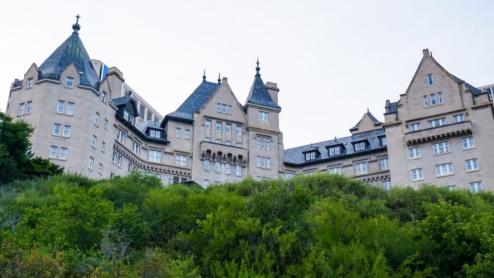
Constructed between 1912 and 1915 for the Grand Trunk Pacific Railway, the château-style hotel rose above the river escarpment as a monument to Edmonton’s confidence. It was practical accommodation for railway travellers, but it was also architectural theatre.
Edmonton wanted to look like a capital.
During our stay at the Fairmont Hotel Macdonald, I spent time looking at archival photographs showing its construction. In some of those images, the hotel towers over a thin skyline with the river and early bridges below.
I called it one of downtown Edmonton’s “OG buildings.”
I was not making a formal historical claim. It was not the city’s first structure or its only important early landmark. But those photographs showed how dramatically it once stood out.
We stayed at the hotel ourselves, and it remains one of the most immersive ways to place your Edmonton accommodation inside the city’s railway-era history. Travellers drawn to that experience can check current availability at Fairmont Hotel Macdonald.
The Legislature, University of Alberta, High Level Bridge and Hotel Macdonald all emerged within roughly the same decade. Together they gave Edmonton much of the identity it still projects: provincial capital, university centre, transportation hub and ambitious river city.
The timing was spectacular.
It was also terrible.
The boom ended with a thud
Edmonton’s growth encouraged a speculative frenzy in land and construction. In 1913, the real-estate market collapsed.
The First World War followed, ending the city’s most exuberant building period. Edmonton entered years of slower development and uneven recovery.
The Second World War later brought a new strategic function. The city became an important base for the construction of the Alaska Highway, strengthening its position as a northern transportation and supply centre.
Then oil changed the scale of everything.
The Leduc oil discovery of 1947 occurred south of Edmonton, not within the city itself. Its impact nevertheless transformed Edmonton’s economy, population and physical footprint.
The city grew from 118,541 people in 1947 to more than 276,000 by 1961. By 1970, it had surpassed 429,000. Annexations affected some of those totals, but they do not alter the basic reality: Edmonton more than doubled in size during the postwar period.
New jobs attracted residents. Roads expanded. Car ownership encouraged suburban neighbourhoods, shopping centres and outward growth.
Downtown changed just as dramatically. High-rises and commercial complexes replaced many older buildings. Pedways created climate-controlled routes above and below streets, which is an understandable response to an Edmonton winter even if it does not produce the liveliest sidewalks.
Growth brought opportunity and convenience. It also erased much of the earlier city.
That helps explain why Edmonton can feel younger than it is. The city possesses deep historical layers, but many of its older buildings were demolished, replaced or surrounded by developments from entirely different eras.
Oil deserves a large place in this story. It does not deserve the whole story.
Edmonton was already Alberta’s capital and home to its major university. Provincial administration, education, transportation and regional services continued driving growth. Returning soldiers moved into urban life. Immigration brought new communities, businesses and cultural traditions.
The city became bigger, richer, more suburban and more internationally connected.
That was the Edmonton waiting for me in the early 2000s.
The city where my tastebuds grew up
I arrived in Edmonton with a very limited understanding of big-city life and an equally limited food vocabulary.
Edmonton changed both.
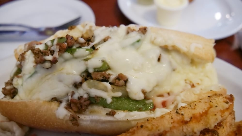
It was where I first tried sushi. It introduced me to Thai, Indian and Korean food. I discovered flavours that had never appeared in my small-town upbringing and started treating meals as part of how I explored a place.
Edmonton is where I became a full-fledged foodie.
I do not claim that my student meals provide a complete history of immigration or cultural change. I was a young guy eating his way around the city, not conducting a demographic study. But the range of food available to me revealed something real about Edmonton.
The city was far more international than outsiders gave it credit for.
Its diversity did not always announce itself through polished tourist districts. You found it in restaurants scattered across neighbourhoods, in strip malls, along Whyte Avenue and in places that required travelling well beyond downtown.
That suited Edmonton’s personality.
It was never overly polished. It could be sprawling, freezing and a little blunt. Yet beneath that rougher exterior was a city with serious cultural depth.
My first class may have been larger than my high school, but the education did not stop on campus. Edmonton introduced me to new people, cuisines and ways of living.
My tastebuds really did receive the better degree.
Returning to my second hometown
When I left Edmonton, I did not know I would be gone for nearly twenty years.
Life moved in other directions. I travelled, lived abroad and gradually accumulated about 75 countries’ worth of experiences before returning with Audrey.
That created a strange situation. I knew Edmonton, but I no longer knew the current version of it.
The LRT had expanded. The funicular made the river valley more accessible from downtown. Rogers Place and the ICE District had altered the city’s hockey geography.
During my student years, I bought ticket packs and watched the Oilers at their former arena. On our return, I stood outside the new downtown venue wearing a newly purchased Oilers hat and trying to reconcile the scene with the Edmonton stored in my memory.
Other places required less adjustment.
Whyte Avenue still felt independent and cultural. The river valley remained my favourite escape. Walking near my old university and the places where I had lived brought back memories faster than any formal historical display could.
Some of my favourite return moments happened away from the camera. I wandered through my former neighbourhoods and tried to determine what had changed, what had disappeared and whether my memory could still be trusted.
Audrey approached Edmonton without that baggage. She was seeing it for the first time. Her reaction to Whyte Avenue reminded me how incomplete the city can appear when visitors experience only downtown or West Edmonton Mall.
My own perspective was incomplete when I lived there too.
As a student, I knew Edmonton through classes, work, food, hockey and ordinary routines. I did not properly understand the Indigenous history beneath the city, Strathcona’s separate municipal past or the political contest that made Edmonton the capital.
Returning after years of travel made me more interested in those layers.
Edmonton had matured while I was away.
So had I.
For a first trip centred on the city’s history, downtown is the most straightforward base for the Legislature, Jasper Avenue, Hotel Macdonald, the ICE District and access to the river valley. Old Strathcona still deserves its own journey across the river rather than being squeezed into whatever time remains. Travellers choosing among budgets and hotel styles can compare places to stay in Downtown Edmonton.
Edmonton’s rapid transformation in dates
| Period or date | What happened |
|---|---|
| Long before European settlement | Indigenous communities used the river valley for movement, trade, ceremony, diplomacy and gathering |
| 1795 | Fort Augustus and Edmonton House were established |
| 1802 | The competing fur-trade posts moved to the Rossdale Flats |
| 1830 | The final Fort Edmonton was built on higher ground near today’s Legislature |
| 1876–1877 | Treaty 6 was signed, followed by the Edmonton adhesion |
| 1891 | The railway reached the south bank and South Edmonton began growing |
| 1892 | Edmonton became a town |
| 1899 | South Edmonton became the town of Strathcona |
| 1904 | Edmonton became a city |
| 1905–1906 | Alberta became a province and Edmonton secured permanent capital status |
| 1908 | The University of Alberta opened in Strathcona |
| 1912 | Edmonton and Strathcona amalgamated; the Legislature officially opened |
| 1913 | The High Level Bridge was completed as the speculative boom collapsed |
| 1915 | Hotel Macdonald opened above the river valley |
| 1947 | The Leduc oil discovery began a new era of regional growth |
| Early 2000s | I moved from Gold River to Edmonton to attend the U of A |
| Nearly twenty years later | I returned to a much larger and visibly changed city |
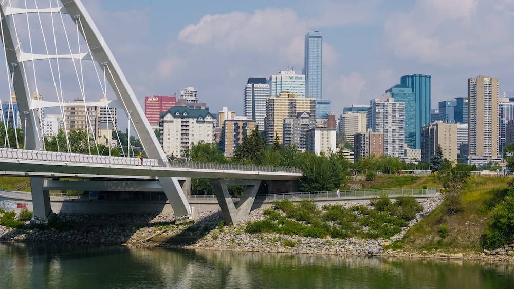
From river crossing to modern capital
Edmonton’s history is not one steady march from trading post to skyline.
The North Saskatchewan River valley was already a place of movement, gathering and exchange before Fort Edmonton existed. Fur traders inserted commercial posts into that older landscape. Treaty relationships, dispossession and settler expansion followed.
Edmonton and Strathcona developed on opposite sides of the river, competed and eventually amalgamated. Provincial politics turned Edmonton from temporary capital into permanent capital. The Legislature and University of Alberta gave it institutional weight. Railways, bridges and speculative construction produced an early metropolitan skyline.
The 1913 collapse stopped that first boom. War redirected the city. Oil later accelerated its growth, while government, education, transportation and immigration made Edmonton more complex than the label “oil city” suggests.
Throughout every period, the river remained.
It was a travel corridor, meeting place, trade route, fort location, municipal barrier and bridge-building problem. Today it is the green space where people walk, run, cycle, ski and briefly forget that they are in a large city.
That is the Edmonton I still recognize.
It was my first big city, the place where my tastebuds evolved and where I grew into adulthood. Returning nearly twenty years later made me realize it had become a second hometown.
Edmonton was not where I grew up.
It was where I grew up again.
Frequently Asked Questions
Why did Edmonton develop beside the North Saskatchewan River?
The river valley had already served as a place of Indigenous movement, trade, gathering, ceremony and diplomacy long before Edmonton existed. It later influenced the placement of fur-trade posts, settlements, bridges and government institutions.
When did Edmonton become the capital of Alberta?
Edmonton was designated Alberta’s temporary capital when the province was created in 1905. Proposals to move the capital elsewhere failed during the first Legislature, leaving Edmonton as the permanent seat of provincial government.
Were Edmonton and Strathcona once separate cities?
Yes. Edmonton developed on the north side of the river, while the railway helped South Edmonton grow into the separate City of Strathcona. They amalgamated in 1912, and the High Level Bridge strengthened the connection between them.
Did oil create modern Edmonton?
Oil accelerated Edmonton’s postwar growth enormously after the 1947 Leduc discovery, but the city was already Alberta’s capital and home to the University of Alberta. Government, education, transportation, immigration and regional services also shaped modern Edmonton.
Where can visitors still see Edmonton’s history?
The river valley, Alberta Legislature, Old Strathcona, Whyte Avenue, High Level Bridge and Fairmont Hotel Macdonald all reveal different layers of the city’s development. Downtown and Old Strathcona are especially useful for understanding how two former cities became one.
What was my personal connection to Edmonton?
Edmonton was the first big city I lived in and the place where I matured as a young adult while attending the U of A. Returning nearly twenty years later made me realize that it had become a second hometown.
This article is also available in Spanish. [Leé la versión en castellano: La historia de Edmonton: del cruce del río a la capital moderna]
This article contains affiliate links. If you book through one of these links, I may earn a commission at no extra cost to you.