
The path running along the Bow River through downtown Banff goes by two names depending on which sign you’re standing next to. Locally, and on most maps, it’s the Bow River Trail. Follow it south toward the falls at the far end of town, though, and you’ll see the same stretch signed as the Bow Falls Trail. They’re not competing trails, just two names for two ends of the same walk.
A Trail With Two Names — And a Few Impostors
One thing worth clearing up before you search for it: there’s more than one “Bow River Trail” in this part of Alberta, and the others aren’t this one. There’s a longer forested loop out by the Lake Louise train station, over an hour’s drive away, and a couple of unrelated river paths further afield in Bow Valley Provincial Park and Kananaskis Country. If a review or a trail app quotes you several miles and a couple of hours, you’ve found one of the impostors. The Banff townsite version is shorter, flatter, and starts right in the middle of things.
Crossing the Bridge, Then Turning Left
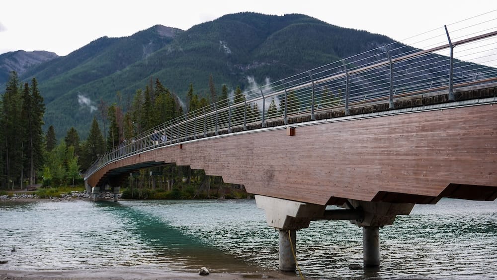
We parked, walked a couple of minutes from downtown, and were on the riverside path almost before we’d registered leaving it — paved, quiet, close enough to town that it barely felt like we’d gone anywhere. The trail crosses a pedestrian bridge over the Bow River, and it was right around there that a local out on his own walk stopped us. He said if we crossed and turned left, there was a quieter stretch he liked better than the main path. We had no reason to doubt him, so we took the tip.
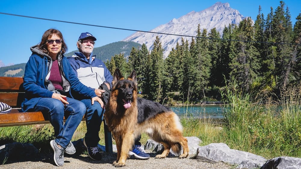
It paid off. The trail narrowed into forest, the town noise dropped away almost completely, and for a while it was just the river somewhere off to our left and birds working through the trees overhead. Togo, the family German Shepherd, trotted along beside us, spooking at nothing more than once, and we told him — in the voice you reserve for nervous dogs — that it was beautiful, Togo, it was fine. After about twenty minutes we came across a row of benches right along the water and stopped, and after four and a half days in a car, it’s hard to overstate how good that first hit of mountain air and turquoise water feels.
That’s when the trip actually started, if I’m being honest. Audrey’s dad had wanted to see the Rockies for decades, and sitting on that bench, he said as much — that this was everything he’d hoped for. I remember feeling the same pull. Everything around us looked untouched, like nobody had ever stood there before us, and that’s not a bad way to open a trip to the Canadian Rockies.
How Long the Walk Actually Takes
The stretch running from Central Park toward the falls end of town covers roughly 1.2 to 1.4 kilometres one-way, depending on exactly where downtown you start counting from. At a relaxed pace, budget twenty to thirty minutes each way. The twenty minutes it took us to reach those first riverside benches was only part of the walk, not the whole thing.
The trail doesn’t only run in that direction, either. Head the other way from Central Park and you’ll reach Fenland Trail in a flat ten to fifteen minutes — a different walk entirely, and not the one this piece is about, but worth knowing about if you’re staying nearby and want a second easy outing. Most of the main path is paved and level, and the stretch from the Muskrat Street access northwest is wheelchair-accessible, so this isn’t a trail that demands hiking boots or any real fitness.
Where the Mountains Actually Appear
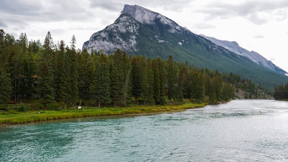
Here’s where I want to be straight with you, because “mountain views” can mean very different things depending on the trail. This isn’t a walk where peaks fill your sightline the entire way. What you get is more specific than that, and honestly more satisfying for it.
Mount Rundle is the first one, and you don’t have to look for it. Cross that pedestrian bridge and it’s directly ahead of you, filling the skyline downstream. That’s the same bridge where we got our directions from the local, and it’s reason enough to stop for a minute even if nobody stops to talk to you. By the time you reach the falls at the far end, Cascade Mountain is looming behind the water and Mount Rundle has swung back into view looking the other way along the river.
If you want the postcard version, the one that ends up on half the Banff photographs you’ll ever see, that’s a short, steeper detour up a set of stairs to Surprise Corner Viewpoint, off the main path. It’s not part of the flat riverside walk, and I’m not going to pretend it is. If you don’t mind the climb, it’s worth doing. If you’re short on time or pushing a stroller, the views from the bridge and the falls end are the honest core of this walk, and they hold up fine on their own.
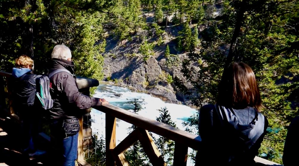
Bow Falls: The Natural Turnaround Point
The trail ends, practically speaking, at Bow Falls, a wide, low waterfall that drops about nine metres across nearly the full hundred-foot width of the Bow River. It’s not a dramatic plunge so much as a broad, steady rush of white water, and the width is really the point. It spans the whole river, which makes it feel bigger than the modest drop suggests.
I’ve walked that same stretch of river again since with just Audrey, and something about it always takes me back to the very first time I ever set foot in Banff, a family day trip long before any of this. Some places do that to you. However many times you come back, it still feels like picking up the same conversation.
The final approach involves a set of wooden stairs as the trail climbs to the falls lookout, the only real elevation change on the whole walk. In winter, those stairs can ice over, so if you’re visiting in the colder months, a pair of traction devices for your shoes will save you a slow, careful shuffle down.
The Pass, the Parking, and a Summer Bonus
You can park at Central Park, at the Surprise Corner lot if you’re doing the uphill detour, or along the street wherever it’s permitted near the river. If you’re staying anywhere central instead of driving in, you can skip the parking question altogether — it’s an easy walk from most downtown Banff hotels, and worth checking current availability for hotels in downtown Banff before a summer visit, since rooms fill up fast in peak season. And don’t overlook the park pass. Because Banff’s townsite sits inside Banff National Park, a valid Parks Canada pass is required any time you’re spending time there, not just when you’re driving through, which is exactly why buying ours was the first thing on our list that morning.
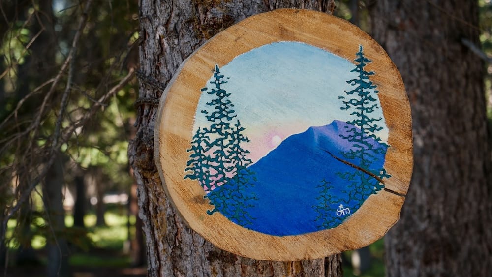
If you’re visiting between July and September, keep an eye out for a rotating outdoor art display along parts of this same corridor, a nice bonus if the timing lines up, though nothing worth reshaping a trip around.
My advice: walk the flat riverside stretch to the falls without a second thought, it’s about as easy as Banff gets. Take the quieter fork if you find one, the way we did. And save Surprise Corner for a day when you’ve got a little more time and energy in the tank. It’s the difference between a nice walk and the view you’ll actually remember.
Frequently Asked Questions
Is the Bow River Trail in Banff difficult?
No. Most of the trail is paved and flat, and the stretch from the Muskrat Street access northwest is wheelchair-accessible. The only real elevation change on the whole walk is a short set of stairs near the Bow Falls lookout at the end.
How long is the Bow River Trail?
The stretch from Central Park toward Bow Falls covers roughly 1.2 to 1.4 kilometres one-way, depending on where downtown you start counting from. At a relaxed pace, budget twenty to thirty minutes each way.
Is the Bow River Trail the same as the Bow Falls Trail?
Yes. They’re the same walk. Locally it’s called the Bow River Trail, but the stretch that leads toward the falls at the south end of town is often signed as the Bow Falls Trail.
Can you actually see mountains from the Bow River Trail?
Yes, but not constantly the whole way. Mount Rundle comes into view as soon as you cross the pedestrian bridge near downtown, and Cascade Mountain looms behind Bow Falls at the far end. The fuller panorama, with the Fairmont Banff Springs Hotel framed against the mountains, requires a short uphill detour to Surprise Corner Viewpoint off the main path.
Do I need a park pass to walk the Bow River Trail?
Yes. Because Banff’s townsite sits inside Banff National Park, a valid Parks Canada pass is required any time you’re spending time there, including a walk like this one, not just when driving through.
Where can I park for the Bow River Trail?
There’s a parking lot at Central Park, another at the Surprise Corner Viewpoint if you’re doing the uphill detour, and street parking where permitted near the river.
Is this the same trail as the Bow River Trail near Lake Louise?
No. There’s a longer forested loop trail near the Lake Louise train station, more than an hour’s drive away, along with unrelated river paths in Bow Valley Provincial Park and Kananaskis Country that share the same name. The Banff townsite version covered here is shorter, flatter, and starts right in downtown Banff.
This guide is also available in Spanish. [Leé la versión en castellano: Bow River Trail en Banff: caminata fácil con vistas a la montaña]
This article contains affiliate links. If you book through one of these links, I may earn a commission at no extra cost to you.